Dolores geodata
Dolores (State of Mexico) is a populated place; located in Mexico in America/Mexico_City (GMT-6) time zone. With population of 1,144 people, there are 7588 cities with bigger population in this country. Compared to other cities in Mexico, 58.3% of cities are located further ↓South; 67.7% of cities are located further →East and 90.8% of cities have lower elevation than Dolores. Note1


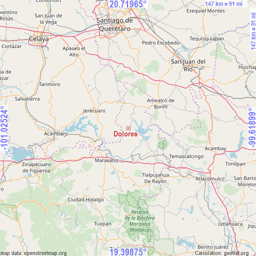
Dolores GPS coordinates[2]
20° 3' 38.124" North, 100° 19' 19.596" West
| Map corner | latitude | longitude |
|---|---|---|
| Upper-left | 20.71965°, | -101.02524° |
| Center: | 20.06059°, | -100.32211° |
| Lower-right: | 19.39875°, | -99.61899° |
| Map W x H: | 146.9×146.9 km | = 91.3×91.3mi |
| max Lat: | 32.7° ⇑41.7% North |
| Dolores: | 20.06059° |
| min Lat: | ⇓58.3% South 14.53588° |
| min Long | Dolores | max Long |
| -117.105° | -100.32211° | -86.73105° |
| W 32.3%⇐ | ⇒67.7% E |
Elevation
Elevation of Dolores is 2434 m = 7986 ft, and this is 1180.3 m = 3872 ft above average elevation for this country.
| Max E: |
3497 m = 11473 ft | 9.2% |
| Dolores | 2434 m 7986 ft | |
| Avg. | 1253.7 m = 4113 ft | |
Min E: |
-1 m = -3 ft | 90.8% |
See also: Mexico elevation on elevation.city.
Geographical zone
Dolores is located in North Torrid zone (between Equator and Tropic of Cancer). Distance of this Northern Tropic circle is 375.4 km =233.3 mi to North.| Distance of | km | miles | from Dolores |
|---|---|---|---|
| North Pole | 7776.5 | 4832.1 | to North |
| Arctic Circle | 5170.6 | 3212.9 | to North |
| Tropic Cancer | 375.4 | 233.3 | to North |
| Equator | 2230.5 | 1386 | to South |


Nearby cities:
15 places around Dolores: (largest is in red/bold)
• Atotonilco
16.8 km =10.4 mi,  142°
142°
• Canindo y Pedregal
7.1 km =4.4 mi,  24°
24°
• Chitejé de Garabato
14.6 km =9.1 mi,  72°
72°
• Colonia Huandishi (Las Chinches)
17 km =10.6 mi,  191°
191°
• Coroneo
16.1 km =10 mi,  343°
343°
• El Gigante
16.6 km =10.3 mi,  233°
233°
• El Varal
15.2 km =9.4 mi, 67°
• Epitacio Huerta
8.8 km =5.5 mi, 20°
• La Higuerilla (Los Lirios)
16.1 km =10 mi,  162°
162°
• Las Pilas de Puruagua
11.8 km =7.3 mi,  256°
256°
• Llano Largo (Santa Rosa de Lima)
14.5 km =9 mi,  106°
106°
• Puroagua
13.8 km =8.6 mi,  278°
278°
• San Antonio Molinos
11.3 km =7 mi,  81°
81°
• Temascales (El Jacal)
15.9 km =9.9 mi,  92°
92°
• Tepuxtepec
12.7 km =7.9 mi,  127°
127°
Sources, notices
• [Note1] Compared only with cities in Mexico existing in our database
• [Src1] Map data: © OpenStreetMap contributors (CC-BY-SA)
• [Src2] Other city data from geonames.org with taken over terms of usage.
• [Src3] Geographical zone / Annual Mean Temperature by Robert A. Rohde @ Wikipedia
