El Ciruelar geodata
El Ciruelar (Guerrero) is a populated place; located in Mexico in America/Mexico_City (GMT-6) time zone. With population of 705 people, there are 12337 cities with bigger population in this country. Compared to other cities in Mexico, 86.9% of cities are located further ↑North; 68.8% of cities are located further →East and 86.3% of cities have higher elevation than El Ciruelar. Note1


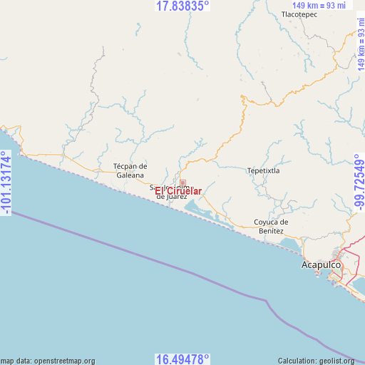
El Ciruelar GPS coordinates[2]
17° 10' 4.008" North, 100° 25' 42.996" West
| Map corner | latitude | longitude |
|---|---|---|
| Upper-left | 17.83835°, | -101.13174° |
| Center: | 17.16778°, | -100.42861° |
| Lower-right: | 16.49478°, | -99.72549° |
| Map W x H: | 149.4×149.4 km | = 92.8×92.8mi |
| max Lat: | 32.7° ⇑86.9% North |
| El Ciruelar: | 17.16778° |
| min Lat: | ⇓13.1% South 14.53588° |
| min Long | El Ciruelar | max Long |
| -117.105° | -100.42861° | -86.73105° |
| W 31.2%⇐ | ⇒68.8% E |
Elevation
Elevation of El Ciruelar is 37 m = 121 ft, and this is 1216.7 m = 3992 ft below average elevation for this country.
| Max E: |
3497 m = 11473 ft | 86.3% |
| Avg. | 1253.7 m = 4113 ft | |
| El Ciruelar | 37 m = 121 ft | |
Min E: |
-1 m = -3 ft | 13.7% |
See also: Mexico elevation on elevation.city.
Geographical zone
El Ciruelar is located in North Torrid zone (between Equator and Tropic of Cancer). Distance of this Northern Tropic circle is 697 km =433.1 mi to North.| Distance of | km | miles | from El Ciruelar |
|---|---|---|---|
| North Pole | 8098.2 | 5032 | to North |
| Arctic Circle | 5492.3 | 3412.8 | to North |
| Tropic Cancer | 697 | 433.1 | to North |
| Equator | 1908.9 | 1186.1 | to South |


Nearby cities:
15 places around El Ciruelar: (largest is in red/bold)
• Alcholoa
2.8 km =1.7 mi,  130°
130°
• Arenal de Gómez (Primer Arenal)
4.4 km =2.7 mi,  224°
224°
• Arenal de Álvarez (Arenal de Paco)
5.4 km =3.4 mi,  211°
211°
• Arenal del Centro (La Máquina)
5 km =3.1 mi, 220°
• Atoyac de Álvarez
4.3 km =2.7 mi,  353°
353°
• Cacalutla
9.6 km =6 mi,  120°
120°
• Colonia 2 de Diciembre de 1974
0.7 km =0.4 mi,  26°
26°
• Colonia Buenos Aires
2 km =1.2 mi, 130°
• Colonia Cuauhtémoc
12.2 km =7.6 mi, 126°
• Corral Falso
3.4 km =2.1 mi,  279°
279°
• El Ticui
5.7 km =3.5 mi,  342°
342°
• Hacienda de Cabañas
9.1 km =5.7 mi, 210°
• La Y Griega
0.6 km =0.4 mi,  242°
242°
• Las Tunas
7.9 km =4.9 mi,  227°
227°
• San Jerónimo de Juárez
5.5 km =3.4 mi, 234°
Sources, notices
• [Note1] Compared only with cities in Mexico existing in our database
• [Src1] Map data: © OpenStreetMap contributors (CC-BY-SA)
• [Src2] Other city data from geonames.org with taken over terms of usage.
• [Src3] Geographical zone / Annual Mean Temperature by Robert A. Rohde @ Wikipedia
