Colonia Loma Linda geodata
Colonia Loma Linda (State of Mexico) is a populated place; located in Mexico in America/Mexico_City (GMT-6) time zone. With population of 660 people, there are 13154 cities with bigger population in this country. Compared to other cities in Mexico, 62.1% of cities are located further ↑North; 56.8% of cities are located further →East and 95.3% of cities have lower elevation than Colonia Loma Linda. Note1


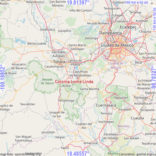
Colonia Loma Linda GPS coordinates[2]
19° 9' 3.996" North, 99° 29' 11.004" West
| Map corner | latitude | longitude |
|---|---|---|
| Upper-left | 19.81397°, | -100.18952° |
| Center: | 19.15111°, | -99.48639° |
| Lower-right: | 18.48557°, | -98.78327° |
| Map W x H: | 147.7×147.7 km | = 91.8×91.8mi |
| max Lat: | 32.7° ⇑62.1% North |
| Colonia Loma Linda: | 19.15111° |
| min Lat: | ⇓37.9% South 14.53588° |
| min Long | Colonia Loma Li | max Long |
| -117.105° | -99.48639° | -86.73105° |
| W 43.2%⇐ | ⇒56.8% E |
Elevation
Elevation of Colonia Loma Linda is 2603 m = 8540 ft, and this is 1349.3 m = 4427 ft above average elevation for this country.
| Max E: |
3497 m = 11473 ft | 4.7% |
| Colonia Loma Linda | 2603 m 8540 ft | |
| Avg. | 1253.7 m = 4113 ft | |
Min E: |
-1 m = -3 ft | 95.3% |
See also: Mexico elevation on elevation.city.
Geographical zone
Colonia Loma Linda is located in North Torrid zone (between Equator and Tropic of Cancer). Distance of this Northern Tropic circle is 476.5 km =296.1 mi to North.| Distance of | km | miles | from Colonia Loma Linda |
|---|---|---|---|
| North Pole | 7877.7 | 4895 | to North |
| Arctic Circle | 5271.8 | 3275.7 | to North |
| Tropic Cancer | 476.5 | 296.1 | to North |
| Equator | 2129.4 | 1323.1 | to South |


Nearby cities:
15 places around Colonia Loma Linda: (largest is in red/bold)
• Ahuatenco
3.5 km =2.2 mi,  119°
119°
• Almoloya del Río
1 km =0.6 mi,  354°
354°
• Capulhuac de Mirafuentes
5.2 km =3.2 mi,  24°
24°
• Colonia la Libertad
4.2 km =2.6 mi,  335°
335°
• Colonia las Granjas
4.9 km =3 mi,  49°
49°
• Mezapa la Fábrica
5.1 km =3.2 mi,  57°
57°
• San José Mezapa Sección I
3.6 km =2.2 mi,  68°
68°
• San Lorenzo Huehuetitlán
1.9 km =1.2 mi,  166°
166°
• San Mateo Texcalyacac
2.7 km =1.7 mi, 50°
• Santa Cruz Atizapán
2.9 km =1.8 mi,  355°
355°
• Santa Fe Mezapa
3.8 km =2.4 mi, 73°
• Santiago Tianguistenco de Galeana
3.9 km =2.4 mi,  32°
32°
• Texcalyacac
2.6 km =1.6 mi,  217°
217°
• Tlacomulco
5.3 km =3.3 mi,  129°
129°
• Tlaminca
5.2 km =3.2 mi,  109°
109°
Sources, notices
• [Note1] Compared only with cities in Mexico existing in our database
• [Src1] Map data: © OpenStreetMap contributors (CC-BY-SA)
• [Src2] Other city data from geonames.org with taken over terms of usage.
• [Src3] Geographical zone / Annual Mean Temperature by Robert A. Rohde @ Wikipedia
