Oyametepec geodata
Oyametepec (Puebla) is a populated place; located in Mexico in America/Mexico_City (GMT-6) time zone. With population of 658 people, there are 13187 cities with bigger population in this country. Compared to other cities in Mexico, 52.9% of cities are located further ↑North; 66.6% of cities are located further ←West and 98.7% of cities have lower elevation than Oyametepec. Note1


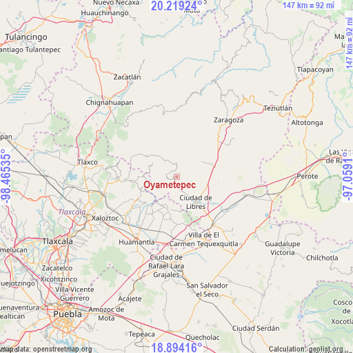
Oyametepec GPS coordinates[2]
19° 33' 29.016" North, 97° 45' 43.992" West
| Map corner | latitude | longitude |
|---|---|---|
| Upper-left | 20.21924°, | -98.46535° |
| Center: | 19.55806°, | -97.76222° |
| Lower-right: | 18.89416°, | -97.0591° |
| Map W x H: | 147.3×147.3 km | = 91.5×91.5mi |
| max Lat: | 32.7° ⇑52.9% North |
| Oyametepec: | 19.55806° |
| min Lat: | ⇓47.1% South 14.53588° |
| min Long | Oyametepec | max Long |
| -117.105° | -97.76222° | -86.73105° |
| W 66.6%⇐ | ⇒33.4% E |
Elevation
Elevation of Oyametepec is 2807 m = 9209 ft, and this is 1553.3 m = 5096 ft above average elevation for this country.
| Max E: |
3497 m = 11473 ft | 1.3% |
| Oyametepec | 2807 m 9209 ft | |
| Avg. | 1253.7 m = 4113 ft | |
Min E: |
-1 m = -3 ft | 98.7% |
See also: Mexico elevation on elevation.city.
Geographical zone
Oyametepec is located in North Torrid zone (between Equator and Tropic of Cancer). Distance of this Northern Tropic circle is 431.3 km =268 mi to North.| Distance of | km | miles | from Oyametepec |
|---|---|---|---|
| North Pole | 7832.4 | 4866.8 | to North |
| Arctic Circle | 5226.5 | 3247.6 | to North |
| Tropic Cancer | 431.3 | 268 | to North |
| Equator | 2174.7 | 1351.3 | to South |


Nearby cities:
15 places around Oyametepec: (largest is in red/bold)
• Cruz de León
11.6 km =7.2 mi,  282°
282°
• Cuatexmola (Xonacatitla)
9.3 km =5.8 mi,  228°
228°
• El Mirador
1 km =0.6 mi,  263°
263°
• El Mirador (San Francisco)
10.8 km =6.7 mi,  102°
102°
• Guadalupe Victoria
10.7 km =6.6 mi,  89°
89°
• Ixtacamaxtitlán
9.2 km =5.7 mi,  322°
322°
• La Cañada
7.2 km =4.5 mi,  155°
155°
• La Unión Ejido Mexcaltepec
7.8 km =4.8 mi,  44°
44°
• San José la Libertad
10.3 km =6.4 mi,  142°
142°
• Tateno
7 km =4.3 mi, 38°
• Tehuatzingo
9.8 km =6.1 mi,  115°
115°
• Temextla
11.5 km =7.1 mi,  60°
60°
• Tepexoxuca
4.2 km =2.6 mi,  14°
14°
• Texocuixpan
9.4 km =5.8 mi,  301°
301°
• Tonalapa
2.9 km =1.8 mi,  244°
244°
Sources, notices
• [Note1] Compared only with cities in Mexico existing in our database
• [Src1] Map data: © OpenStreetMap contributors (CC-BY-SA)
• [Src2] Other city data from geonames.org with taken over terms of usage.
• [Src3] Geographical zone / Annual Mean Temperature by Robert A. Rohde @ Wikipedia
