Cuatexmola (Xonacatitla) geodata
Cuatexmola (Xonacatitla) (Puebla) is a populated place; located in Mexico in America/Mexico_City (GMT-6) time zone. With population of 961 people, there are 9056 cities with bigger population in this country. Compared to other cities in Mexico, 54% of cities are located further ↑North; 65.7% of cities are located further ←West and 100% of cities have lower elevation than Cuatexmola (Xonacatitla). Note1
Current local time in Cuatexmola (Xonacatitla):
08:32 AM, WednesdayDifference from your time zone: hours


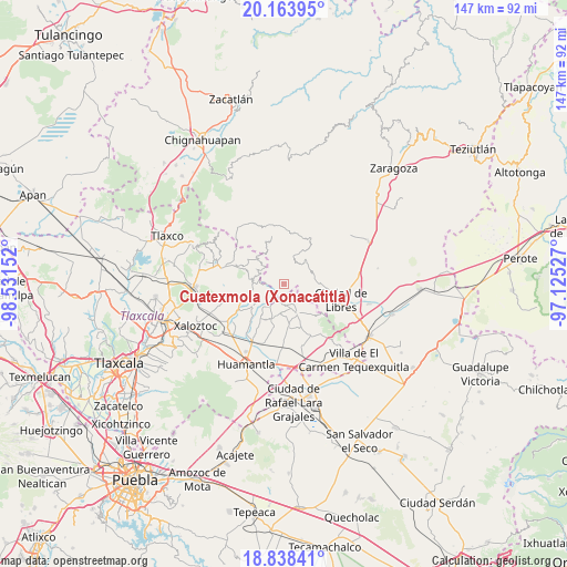
Cuatexmola (Xonacatitla) GPS coordinates[2]
19° 30' 9.144" North, 97° 49' 42.204" West
| Map corner | latitude | longitude |
|---|---|---|
| Upper-left | 20.16395°, | -98.53152° |
| Center: | 19.50254°, | -97.82839° |
| Lower-right: | 18.83841°, | -97.12527° |
| Map W x H: | 147.4×147.4 km | = 91.6×91.6mi |
| max Lat: | 32.7° ⇑54% North |
| Cuatexmola (Xonacatitla): | 19.50254° |
| min Lat: | ⇓46% South 14.53588° |
| min Long | Cuatexmola (Xon | max Long |
| -117.105° | -97.82839° | -86.73105° |
| W 65.7%⇐ | ⇒34.3% E |
Elevation
Elevation of Cuatexmola (Xonacatitla) is 3167 m = 10390 ft, and this is 1913.3 m = 6277 ft above average elevation for this country.
| Max E: |
3497 m = 11473 ft | 0% |
| Cuatexmola (Xonacatitla) | 3167 m 10390 ft | |
| Avg. | 1253.7 m = 4113 ft | |
Min E: |
-1 m = -3 ft | 100% |
See also: Mexico elevation on elevation.city.
Geographical zone
Cuatexmola (Xonacatitla) is located in North Torrid zone (between Equator and Tropic of Cancer). Distance of this Northern Tropic circle is 437.4 km =271.8 mi to North.| Distance of | km | miles | from Cuatexmola (Xonacatitla) |
|---|---|---|---|
| North Pole | 7838.6 | 4870.7 | to North |
| Arctic Circle | 5232.7 | 3251.4 | to North |
| Tropic Cancer | 437.4 | 271.8 | to North |
| Equator | 2168.5 | 1347.4 | to South |


Nearby cities:
15 places around Cuatexmola (Xonacatitla): (largest is in red/bold)
• Altzayanca
8.6 km =5.3 mi,  156°
156°
• Atlzayanca
8.7 km =5.4 mi, 156°
• Cristalaco
3.1 km =1.9 mi,  217°
217°
• Cruz de León
9.8 km =6.1 mi,  333°
333°
• El Capulín
10.1 km =6.3 mi,  234°
234°
• El Mirador
8.5 km =5.3 mi,  44°
44°
• Emiliano Zapata
11.2 km =7 mi,  303°
303°
• La Caldera
4.3 km =2.7 mi,  266°
266°
• La Cañada
9.9 km =6.2 mi,  92°
92°
• Oyametepec
9.3 km =5.8 mi,  48°
48°
• San José Villarreal
8 km =5 mi,  294°
294°
• Terrenate
10 km =6.2 mi,  253°
253°
• Texocuixpan
11.1 km =6.9 mi,  354°
354°
• Tonalapa
6.6 km =4.1 mi, 41°
• Xaltitla
10.6 km =6.6 mi,  147°
147°
Sources, notices
• [Note1] Compared only with cities in Mexico existing in our database
• [Src1] Map data: © OpenStreetMap contributors (CC-BY-SA)
• [Src2] Other city data from geonames.org with taken over terms of usage.
• [Src3] Geographical zone / Annual Mean Temperature by Robert A. Rohde @ Wikipedia
