Rancho el Calvarito geodata
Rancho el Calvarito (Guanajuato) is a populated place; located in Mexico in America/Mexico_City (GMT-6) time zone. With population of 651 people, there are 13306 cities with bigger population in this country. Compared to other cities in Mexico, 79.2% of cities are located further ↓South; 72.8% of cities are located further →East and 70.2% of cities have lower elevation than Rancho el Calvarito. Note1
Administrative division(s):
- Level 1: Guanajuato
- Level 2: Dolores Hidalgo Cuna de la Independencia Nacional


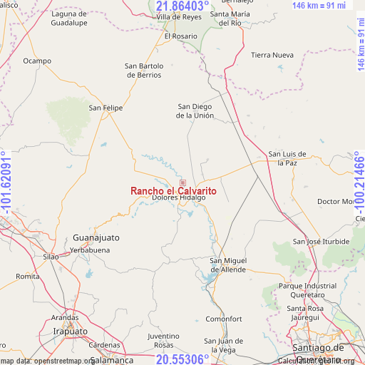
Rancho el Calvarito GPS coordinates[2]
21° 12' 36" North, 100° 55' 4.008" West
| Map corner | latitude | longitude |
|---|---|---|
| Upper-left | 21.86403°, | -101.62091° |
| Center: | 21.21°, | -100.91778° |
| Lower-right: | 20.55306°, | -100.21466° |
| Map W x H: | 145.8×145.8 km | = 90.6×90.6mi |
| max Lat: | 32.7° ⇑20.8% North |
| Rancho el Calvarito: | 21.21° |
| min Lat: | ⇓79.2% South 14.53588° |
| min Long | Rancho el Calva | max Long |
| -117.105° | -100.91778° | -86.73105° |
| W 27.2%⇐ | ⇒72.8% E |
Elevation
Elevation of Rancho el Calvarito is 1929 m = 6329 ft, and this is 675.3 m = 2216 ft above average elevation for this country.
| Max E: |
3497 m = 11473 ft | 29.8% |
| Rancho el Calvarito | 1929 m 6329 ft | |
| Avg. | 1253.7 m = 4113 ft | |
Min E: |
-1 m = -3 ft | 70.2% |
See also: Mexico elevation on elevation.city.
Geographical zone
Rancho el Calvarito is located in North Torrid zone (between Equator and Tropic of Cancer). Distance of this Northern Tropic circle is 247.6 km =153.9 mi to North.| Distance of | km | miles | from Rancho el Calvarito |
|---|---|---|---|
| North Pole | 7648.7 | 4752.7 | to North |
| Arctic Circle | 5042.8 | 3133.4 | to North |
| Tropic Cancer | 247.6 | 153.9 | to North |
| Equator | 2358.3 | 1465.4 | to South |


Nearby cities:
15 places around Rancho el Calvarito: (largest is in red/bold)
• Colonia Francisco I. Madero
7.8 km =4.8 mi,  221°
221°
• Colonia Padre Hidalgo
4.8 km =3 mi,  202°
202°
• Dolores Hidalgo Cuna de la Independencia Nacional
6.2 km =3.9 mi,  194°
194°
• Ejido Dolores
5.4 km =3.4 mi, 204°
• Ejido Jesús María
7.6 km =4.7 mi,  175°
175°
• El Gallinero
5.4 km =3.4 mi,  234°
234°
• El Llanito
10.4 km =6.5 mi, 199°
• La Cruz del Padre Razo (Las Crucitas)
2.9 km =1.8 mi, 193°
• Rancho de Guadalupe
9.6 km =6 mi,  274°
274°
• Río Laja
0.9 km =0.6 mi, 217°
• San Diego del Llanito
8 km =5 mi, 199°
• Santa Clara
10.2 km =6.3 mi,  146°
146°
• Sebastián
5.8 km =3.6 mi, 150°
• Soledad Nueva
7.7 km =4.8 mi,  356°
356°
• Xoconoxtlito del Llanito
9.7 km =6 mi,  207°
207°
Sources, notices
• [Note1] Compared only with cities in Mexico existing in our database
• [Src1] Map data: © OpenStreetMap contributors (CC-BY-SA)
• [Src2] Other city data from geonames.org with taken over terms of usage.
• [Src3] Geographical zone / Annual Mean Temperature by Robert A. Rohde @ Wikipedia
