Sección 10 de Azucareros geodata
Sección 10 de Azucareros (Tabasco) is a populated place; located in Mexico in America/Mexico_City (GMT-6) time zone. With population of 628 people, there are 13781 cities with bigger population in this country. Compared to other cities in Mexico, 79.2% of cities are located further ↑North; 86.9% of cities are located further ←West and 89% of cities have higher elevation than Sección 10 de Azucareros. Note1
Current local time in Sección 10 de Azucareros:
10:06 AM, MondayDifference from your time zone: hours


Sección 10 de Azucareros GPS coordinates[2]
17° 57' 14.004" North, 93° 21' 46.008" West
| Map corner | latitude | longitude |
|---|---|---|
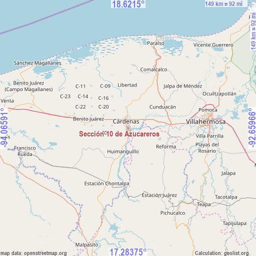
| Upper-left | 18.6215°, | -94.06591° |
| Center: | 17.95389°, | -93.36278° |
| Lower-right: | 17.28375°, | -92.65966° |
| Map W x H: | 148.7×148.7 km | = 92.4×92.4mi |
| max Lat: | 32.7° ⇑79.2% North |
| Sección 10 de Azucareros: | 17.95389° |
| min Lat: | ⇓20.8% South 14.53588° |
| min Long | Sección 10 de | max Long |
| -117.105° | -93.36278° | -86.73105° |
| W 86.9%⇐ | ⇒13.1% E |
Elevation
Elevation of Sección 10 de Azucareros is 27 m = 89 ft, and this is 1226.7 m = 4025 ft below average elevation for this country.
| Max E: |
3497 m = 11473 ft | 89% |
| Avg. | 1253.7 m = 4113 ft | |
| Sección 10 de Azucareros | 27 m = 89 ft | |
Min E: |
-1 m = -3 ft | 11% |
See also: Mexico elevation on elevation.city.
Geographical zone
Sección 10 de Azucareros is located in North Torrid zone (between Equator and Tropic of Cancer). Distance of this Northern Tropic circle is 609.6 km =378.8 mi to North.| Distance of | km | miles | from Sección 10 de Azucareros |
|---|---|---|---|
| North Pole | 8010.8 | 4977.7 | to North |
| Arctic Circle | 5404.9 | 3358.4 | to North |
| Tropic Cancer | 609.6 | 378.8 | to North |
| Equator | 1996.3 | 1240.4 | to South |


Nearby cities:
15 places around Sección 10 de Azucareros: (largest is in red/bold)
• Arroyo Hondo Abejonal
5.7 km =3.5 mi,  297°
297°
• Bajío 1ra. Sección A (Perifércio Sur)
3.5 km =2.2 mi,  13°
13°
• Benito Juárez (La Playita)
2.4 km =1.5 mi,  184°
184°
• C-41 (Licenciado Carlos A. Madrazo)
9.7 km =6 mi,  249°
249°
• Carlos Alberto Wilson Gómez
7.6 km =4.7 mi,  27°
27°
• Celia González de Rovirosa
11.7 km =7.3 mi,  357°
357°
• Cárdenas
5.4 km =3.4 mi,  345°
345°
• El Dorado
7.9 km =4.9 mi, 183°
• El Limoncito
8.4 km =5.2 mi,  159°
159°
• Habanero 1ra. Sección (Venustiano Carranza)
4 km =2.5 mi,  67°
67°
• La Península
1.2 km =0.7 mi,  173°
173°
• Los Naranjos 1ra. Sección (Campechito)
2.7 km =1.7 mi, 184°
• Los Naranjos 2da. Sección
8.9 km =5.5 mi,  193°
193°
• Melchor Ocampo
9.2 km =5.7 mi,  0°
0°
• Rafael Pascacio Gamboa
10.8 km =6.7 mi,  111°
111°
Sources, notices
• [Note1] Compared only with cities in Mexico existing in our database
• [Src1] Map data: © OpenStreetMap contributors (CC-BY-SA)
• [Src2] Other city data from geonames.org with taken over terms of usage.
• [Src3] Geographical zone / Annual Mean Temperature by Robert A. Rohde @ Wikipedia
