Sendero Real geodata
Sendero Real (Jalisco) is a populated place; located in Mexico in America/Mexico_City (GMT-6) time zone. With population of 604 people, there are 14253 cities with bigger population in this country. Compared to other cities in Mexico, 68.4% of cities are located further ↓South; 87.4% of cities are located further →East and 52.5% of cities have lower elevation than Sendero Real. Note1


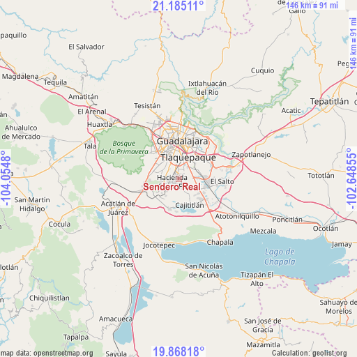
Sendero Real GPS coordinates[2]
20° 31' 41.016" North, 103° 21' 6.012" West
| Map corner | latitude | longitude |
|---|---|---|
| Upper-left | 21.18511°, | -104.0548° |
| Center: | 20.52806°, | -103.35167° |
| Lower-right: | 19.86818°, | -102.64855° |
| Map W x H: | 146.4×146.4 km | = 91×91mi |
| max Lat: | 32.7° ⇑31.6% North |
| Sendero Real: | 20.52806° |
| min Lat: | ⇓68.4% South 14.53588° |
| min Long | Sendero Real | max Long |
| -117.105° | -103.35167° | -86.73105° |
| W 12.6%⇐ | ⇒87.4% E |
Elevation
Elevation of Sendero Real is 1532 m = 5026 ft, and this is 278.3 m = 913 ft above average elevation for this country.
| Max E: |
3497 m = 11473 ft | 47.5% |
| Sendero Real | 1532 m 5026 ft | |
| Avg. | 1253.7 m = 4113 ft | |
Min E: |
-1 m = -3 ft | 52.5% |
See also: Mexico elevation on elevation.city.
Geographical zone
Sendero Real is located in North Torrid zone (between Equator and Tropic of Cancer). Distance of this Northern Tropic circle is 323.4 km =201 mi to North.| Distance of | km | miles | from Sendero Real |
|---|---|---|---|
| North Pole | 7724.6 | 4799.8 | to North |
| Arctic Circle | 5118.7 | 3180.6 | to North |
| Tropic Cancer | 323.4 | 201 | to North |
| Equator | 2282.5 | 1418.3 | to South |


Nearby cities:
15 places around Sendero Real: (largest is in red/bold)
• Altus Bosques
4.9 km =3 mi,  334°
334°
• Colinas del Roble
5.5 km =3.4 mi,  241°
241°
• Hacienda Santa Fe
3.2 km =2 mi,  249°
249°
• Hacienda los Fresnos
4.4 km =2.7 mi,  257°
257°
• Jardines del Edén
1.3 km =0.8 mi,  293°
293°
• La Arbolada Plus
1.6 km =1 mi,  307°
307°
• La Unión del Cuatro
1.8 km =1.1 mi,  282°
282°
• Las Pintas de Arriba
5.9 km =3.7 mi,  30°
30°
• Las Pintitas
6.5 km =4 mi,  51°
51°
• Paseo del Prado
5.6 km =3.5 mi,  316°
316°
• Paseos del Valle [Fraccionamiento]
2 km =1.2 mi,  108°
108°
• Real del Valle (El Paraíso) [Fraccionamiento]
2.7 km =1.7 mi, 315°
• Santa Rosa (Real Tulipanes) [Fraccionamiento]
5.6 km =3.5 mi, 332°
• Valle Dorado Inn
1.1 km =0.7 mi, 249°
• Villas de la Hacienda [Fraccionamiento]
3.3 km =2.1 mi, 275°
Sources, notices
• [Note1] Compared only with cities in Mexico existing in our database
• [Src1] Map data: © OpenStreetMap contributors (CC-BY-SA)
• [Src2] Other city data from geonames.org with taken over terms of usage.
• [Src3] Geographical zone / Annual Mean Temperature by Robert A. Rohde @ Wikipedia
