Asunción Etla geodata
Asunción Etla (Oaxaca) is a populated place; located in Mexico in America/Mexico_City (GMT-6) time zone. With population of 600 people, there are 14337 cities with bigger population in this country. Compared to other cities in Mexico, 86.4% of cities are located further ↑North; 77.3% of cities are located further ←West and 57.3% of cities have lower elevation than Asunción Etla. Note1


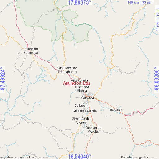
Asunción Etla GPS coordinates[2]
17° 12' 47.988" North, 96° 47' 45.996" West
| Map corner | latitude | longitude |
|---|---|---|
| Upper-left | 17.88373°, | -97.49924° |
| Center: | 17.21333°, | -96.79611° |
| Lower-right: | 16.54049°, | -96.09299° |
| Map W x H: | 149.4×149.4 km | = 92.8×92.8mi |
| max Lat: | 32.7° ⇑86.4% North |
| Asunción Etla: | 17.21333° |
| min Lat: | ⇓13.6% South 14.53588° |
| min Long | Asunción Etla | max Long |
| -117.105° | -96.79611° | -86.73105° |
| W 77.3%⇐ | ⇒22.7% E |
Elevation
Elevation of Asunción Etla is 1670 m = 5479 ft, and this is 416.3 m = 1366 ft above average elevation for this country.
| Max E: |
3497 m = 11473 ft | 42.7% |
| Asunción Etla | 1670 m 5479 ft | |
| Avg. | 1253.7 m = 4113 ft | |
Min E: |
-1 m = -3 ft | 57.3% |
See also: Mexico elevation on elevation.city.
Geographical zone
Asunción Etla is located in North Torrid zone (between Equator and Tropic of Cancer). Distance of this Northern Tropic circle is 692 km =430 mi to North.| Distance of | km | miles | from Asunción Etla |
|---|---|---|---|
| North Pole | 8093.1 | 5028.8 | to North |
| Arctic Circle | 5487.2 | 3409.6 | to North |
| Tropic Cancer | 692 | 430 | to North |
| Equator | 1913.9 | 1189.2 | to South |


Nearby cities:
15 places around Asunción Etla: (largest is in red/bold)
• Alemán
5 km =3.1 mi,  242°
242°
• El Vergel
0.8 km =0.5 mi,  155°
155°
• Fraccionamiento Ex-Hacienda Catano
2.6 km =1.6 mi,  307°
307°
• Fraccionamiento San Miguel
1 km =0.6 mi,  93°
93°
• Guadalupe Etla
4.8 km =3 mi,  198°
198°
• Magdalena Apasco
4 km =2.5 mi,  319°
319°
• Reyes Etla
2.6 km =1.6 mi, 241°
• San Agustín Etla
4.3 km =2.7 mi,  133°
133°
• San Isidro
4 km =2.5 mi, 237°
• San Juan Bautista Guelache
2.6 km =1.6 mi,  45°
45°
• San Lázaro Etla
3.1 km =1.9 mi,  275°
275°
• Santa Martha Etla
4.3 km =2.7 mi,  343°
343°
• Santo Domingo Barrio Alto
1.9 km =1.2 mi, 159°
• Santos Degollado
1.1 km =0.7 mi,  33°
33°
• Villa de Etla
0.9 km =0.6 mi, 200°
Sources, notices
• [Note1] Compared only with cities in Mexico existing in our database
• [Src1] Map data: © OpenStreetMap contributors (CC-BY-SA)
• [Src2] Other city data from geonames.org with taken over terms of usage.
• [Src3] Geographical zone / Annual Mean Temperature by Robert A. Rohde @ Wikipedia
