Alemán geodata
Alemán (Oaxaca) is a populated place; located in Mexico in America/Mexico_City (GMT-6) time zone. With population of 855 people, there are 10232 cities with bigger population in this country. Compared to other cities in Mexico, 86.7% of cities are located further ↑North; 76.8% of cities are located further ←West and 56.3% of cities have lower elevation than Alemán. Note1


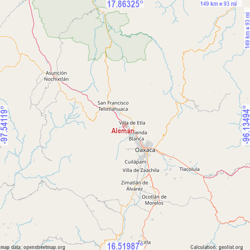
Alemán GPS coordinates[2]
17° 11' 34.008" North, 96° 50' 17.016" West
| Map corner | latitude | longitude |
|---|---|---|
| Upper-left | 17.86325°, | -97.54119° |
| Center: | 17.19278°, | -96.83806° |
| Lower-right: | 16.51987°, | -96.13494° |
| Map W x H: | 149.4×149.4 km | = 92.8×92.8mi |
| max Lat: | 32.7° ⇑86.7% North |
| Alemán: | 17.19278° |
| min Lat: | ⇓13.3% South 14.53588° |
| min Long | Alemán | max Long |
| -117.105° | -96.83806° | -86.73105° |
| W 76.8%⇐ | ⇒23.2% E |
Elevation
Elevation of Alemán is 1632 m = 5354 ft, and this is 378.3 m = 1241 ft above average elevation for this country.
| Max E: |
3497 m = 11473 ft | 43.7% |
| Alemán | 1632 m 5354 ft | |
| Avg. | 1253.7 m = 4113 ft | |
Min E: |
-1 m = -3 ft | 56.3% |
See also: Mexico elevation on elevation.city.
Geographical zone
Alemán is located in North Torrid zone (between Equator and Tropic of Cancer). Distance of this Northern Tropic circle is 694.3 km =431.4 mi to North.| Distance of | km | miles | from Alemán |
|---|---|---|---|
| North Pole | 8095.4 | 5030.2 | to North |
| Arctic Circle | 5489.5 | 3411 | to North |
| Tropic Cancer | 694.3 | 431.4 | to North |
| Equator | 1911.7 | 1187.9 | to South |


Nearby cities:
15 places around Alemán: (largest is in red/bold)
• Asunción Etla
5 km =3.1 mi,  62°
62°
• El Vergel
5 km =3.1 mi,  71°
71°
• Fraccionamiento Ex-Hacienda Catano
4.5 km =2.8 mi,  31°
31°
• Guadalupe Etla
3.7 km =2.3 mi,  127°
127°
• Matadamas
4.3 km =2.7 mi,  148°
148°
• Reyes Etla
2.4 km =1.5 mi, 63°
• San Andrés Zautla
2.8 km =1.7 mi,  256°
256°
• San Isidro
1 km =0.6 mi,  83°
83°
• San Lázaro Etla
2.9 km =1.8 mi, 27°
• Santa Cruz Lachixolana
4.3 km =2.7 mi,  334°
334°
• Santo Domingo Barrio Alto
5.2 km =3.2 mi, 84°
• Santo Domingo Tlaltinango
5.3 km =3.3 mi,  349°
349°
• Santo Tomás Mazaltepec
4.4 km =2.7 mi,  238°
238°
• Tierra y Libertad
1.3 km =0.8 mi,  322°
322°
• Villa de Etla
4.4 km =2.7 mi, 70°
Sources, notices
• [Note1] Compared only with cities in Mexico existing in our database
• [Src1] Map data: © OpenStreetMap contributors (CC-BY-SA)
• [Src2] Other city data from geonames.org with taken over terms of usage.
• [Src3] Geographical zone / Annual Mean Temperature by Robert A. Rohde @ Wikipedia
