Guadalupe Etla geodata
Guadalupe Etla (Oaxaca) is a populated place; located in Mexico in America/Mexico_City (GMT-6) time zone. With population of 1,851 people, there are 4691 cities with bigger population in this country. Compared to other cities in Mexico, 86.8% of cities are located further ↑North; 77.1% of cities are located further ←West and 55.6% of cities have lower elevation than Guadalupe Etla. Note1


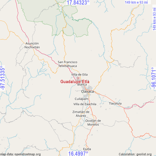
Guadalupe Etla GPS coordinates[2]
17° 10' 21.648" North, 96° 48' 36.792" West
| Map corner | latitude | longitude |
|---|---|---|
| Upper-left | 17.84323°, | -97.51335° |
| Center: | 17.17268°, | -96.81022° |
| Lower-right: | 16.4997°, | -96.1071° |
| Map W x H: | 149.4×149.4 km | = 92.8×92.8mi |
| max Lat: | 32.7° ⇑86.8% North |
| Guadalupe Etla: | 17.17268° |
| min Lat: | ⇓13.2% South 14.53588° |
| min Long | Guadalupe Etla | max Long |
| -117.105° | -96.81022° | -86.73105° |
| W 77.1%⇐ | ⇒22.9% E |
Elevation
Elevation of Guadalupe Etla is 1606 m = 5269 ft, and this is 352.3 m = 1156 ft above average elevation for this country.
| Max E: |
3497 m = 11473 ft | 44.4% |
| Guadalupe Etla | 1606 m 5269 ft | |
| Avg. | 1253.7 m = 4113 ft | |
Min E: |
-1 m = -3 ft | 55.6% |
See also: Mexico elevation on elevation.city.
Geographical zone
Guadalupe Etla is located in North Torrid zone (between Equator and Tropic of Cancer). Distance of this Northern Tropic circle is 696.5 km =432.8 mi to North.| Distance of | km | miles | from Guadalupe Etla |
|---|---|---|---|
| North Pole | 8097.6 | 5031.6 | to North |
| Arctic Circle | 5491.8 | 3412.4 | to North |
| Tropic Cancer | 696.5 | 432.8 | to North |
| Equator | 1909.4 | 1186.4 | to South |


Nearby cities:
15 places around Guadalupe Etla: (largest is in red/bold)
• Alemán
3.7 km =2.3 mi,  307°
307°
• Asunción Etla
4.8 km =3 mi,  18°
18°
• El Vergel
4.2 km =2.6 mi,  25°
25°
• Fraccionamiento San Miguel
5.1 km =3.2 mi, 29°
• Guadalupe Hidalgo
2.6 km =1.6 mi,  182°
182°
• Matadamas
1.6 km =1 mi,  206°
206°
• Poblado Morelos
4.4 km =2.7 mi,  122°
122°
• Reyes Etla
3.4 km =2.1 mi,  345°
345°
• San Agustín Etla
4.9 km =3 mi,  71°
71°
• San Isidro
3 km =1.9 mi,  320°
320°
• San Sebastián Etla
3 km =1.9 mi,  107°
107°
• Santiago Etla
3.1 km =1.9 mi,  135°
135°
• Santo Domingo Barrio Alto
3.5 km =2.2 mi,  38°
38°
• Tierra y Libertad
5 km =3.1 mi, 311°
• Villa de Etla
3.9 km =2.4 mi, 17°
Sources, notices
• [Note1] Compared only with cities in Mexico existing in our database
• [Src1] Map data: © OpenStreetMap contributors (CC-BY-SA)
• [Src2] Other city data from geonames.org with taken over terms of usage.
• [Src3] Geographical zone / Annual Mean Temperature by Robert A. Rohde @ Wikipedia
