Arroyo Largo geodata
Arroyo Largo (Veracruz) is a populated place; located in Mexico in America/Mexico_City (GMT-6) time zone. With population of 586 people, there are 14641 cities with bigger population in this country. Compared to other cities in Mexico, 73.6% of cities are located further ↑North; 83.3% of cities are located further ←West and 89% of cities have higher elevation than Arroyo Largo. Note1


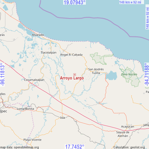
Arroyo Largo GPS coordinates[2]
18° 24' 48.996" North, 95° 24' 54" West
| Map corner | latitude | longitude |
|---|---|---|
| Upper-left | 19.07943°, | -96.11813° |
| Center: | 18.41361°, | -95.415° |
| Lower-right: | 17.7452°, | -94.71188° |
| Map W x H: | 148.4×148.4 km | = 92.2×92.2mi |
| max Lat: | 32.7° ⇑73.6% North |
| Arroyo Largo: | 18.41361° |
| min Lat: | ⇓26.4% South 14.53588° |
| min Long | Arroyo Largo | max Long |
| -117.105° | -95.415° | -86.73105° |
| W 83.3%⇐ | ⇒16.7% E |
Elevation
Elevation of Arroyo Largo is 27 m = 89 ft, and this is 1226.7 m = 4025 ft below average elevation for this country.
| Max E: |
3497 m = 11473 ft | 89% |
| Avg. | 1253.7 m = 4113 ft | |
| Arroyo Largo | 27 m = 89 ft | |
Min E: |
-1 m = -3 ft | 11% |
See also: Mexico elevation on elevation.city.
Geographical zone
Arroyo Largo is located in North Torrid zone (between Equator and Tropic of Cancer). Distance of this Northern Tropic circle is 558.5 km =347 mi to North.| Distance of | km | miles | from Arroyo Largo |
|---|---|---|---|
| North Pole | 7959.7 | 4945.9 | to North |
| Arctic Circle | 5353.8 | 3326.7 | to North |
| Tropic Cancer | 558.5 | 347 | to North |
| Equator | 2047.4 | 1272.2 | to South |


Nearby cities:
15 places around Arroyo Largo: (largest is in red/bold)
• Arroyo San Isidro
8.1 km =5 mi,  1°
1°
• Boca del Monte
5.1 km =3.2 mi,  126°
126°
• Francisco I. Madero
11.1 km =6.9 mi,  150°
150°
• Los Lirios
10.1 km =6.3 mi,  16°
16°
• Maxyapán
10.4 km =6.5 mi,  99°
99°
• Medellín
5.2 km =3.2 mi,  86°
86°
• Ojo de Agua
6.6 km =4.1 mi, 132°
• Rincón de Zapatero
7.6 km =4.7 mi, 133°
• San Antonio de la Huerta
4.2 km =2.6 mi,  204°
204°
• San Leopoldo
11.1 km =6.9 mi,  108°
108°
• Sehualaca
9.8 km =6.1 mi,  81°
81°
• Tibernal
10 km =6.2 mi,  173°
173°
• Tlapacoyan
5 km =3.1 mi, 17°
• Tres Zapotes
6.5 km =4 mi,  339°
339°
• Vista Hermosa
10.1 km =6.3 mi, 81°
Sources, notices
• [Note1] Compared only with cities in Mexico existing in our database
• [Src1] Map data: © OpenStreetMap contributors (CC-BY-SA)
• [Src2] Other city data from geonames.org with taken over terms of usage.
• [Src3] Geographical zone / Annual Mean Temperature by Robert A. Rohde @ Wikipedia
