Barrio Acosta Lagunes geodata
Barrio Acosta Lagunes (Veracruz) is a populated place; located in Mexico in America/Mexico_City (GMT-6) time zone. With population of 580 people, there are 14779 cities with bigger population in this country. Compared to other cities in Mexico, 71.6% of cities are located further ↓South; 71.4% of cities are located further ←West and 87.2% of cities have higher elevation than Barrio Acosta Lagunes. Note1
Current local time in Barrio Acosta Lagunes:
05:21 AM, WednesdayDifference from your time zone: hours


Barrio Acosta Lagunes GPS coordinates[2]
20° 41' 40.992" North, 97° 18' 51.984" West
| Map corner | latitude | longitude |
|---|---|---|
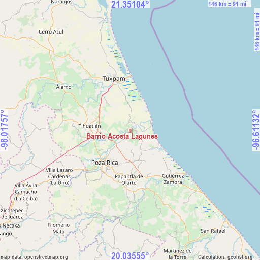
| Upper-left | 21.35104°, | -98.01757° |
| Center: | 20.69472°, | -97.31444° |
| Lower-right: | 20.03555°, | -96.61132° |
| Map W x H: | 146.3×146.3 km | = 90.9×90.9mi |
| max Lat: | 32.7° ⇑28.4% North |
| Barrio Acosta Lagunes: | 20.69472° |
| min Lat: | ⇓71.6% South 14.53588° |
| min Long | Barrio Acosta L | max Long |
| -117.105° | -97.31444° | -86.73105° |
| W 71.4%⇐ | ⇒28.6% E |
Elevation
Elevation of Barrio Acosta Lagunes is 33 m = 108 ft, and this is 1220.7 m = 4005 ft below average elevation for this country.
| Max E: |
3497 m = 11473 ft | 87.2% |
| Avg. | 1253.7 m = 4113 ft | |
| Barrio Acosta Lagunes | 33 m = 108 ft | |
Min E: |
-1 m = -3 ft | 12.8% |
See also: Mexico elevation on elevation.city.
Geographical zone
Barrio Acosta Lagunes is located in North Torrid zone (between Equator and Tropic of Cancer). Distance of this Northern Tropic circle is 304.9 km =189.5 mi to North.| Distance of | km | miles | from Barrio Acosta Lagunes |
|---|---|---|---|
| North Pole | 7706 | 4788.3 | to North |
| Arctic Circle | 5100.1 | 3169.1 | to North |
| Tropic Cancer | 304.9 | 189.5 | to North |
| Equator | 2301 | 1429.8 | to South |


Nearby cities:
15 places around Barrio Acosta Lagunes: (largest is in red/bold)
• Acontitla
7.4 km =4.6 mi,  259°
259°
• Cabellal Número Uno
2.3 km =1.4 mi,  205°
205°
• Caristay
5.6 km =3.5 mi,  170°
170°
• Cazones de Herrera
1.2 km =0.7 mi,  23°
23°
• Cruz Blanca Número Uno
7.1 km =4.4 mi,  148°
148°
• El Sauce
5 km =3.1 mi,  316°
316°
• El Volador
8.9 km =5.5 mi,  130°
130°
• La Ceiba
9.3 km =5.8 mi,  25°
25°
• La Concepción
10.4 km =6.5 mi,  240°
240°
• La Encantada
6.6 km =4.1 mi,  53°
53°
• La Piedad
4.6 km =2.9 mi, 238°
• Limón Chiquito
3.7 km =2.3 mi,  115°
115°
• Manlio Fabio Altamirano
5.9 km =3.7 mi,  352°
352°
• Nuevo Tejamanil
8.7 km =5.4 mi,  291°
291°
• Plan de Limón
5.7 km =3.5 mi, 131°
Sources, notices
• [Note1] Compared only with cities in Mexico existing in our database
• [Src1] Map data: © OpenStreetMap contributors (CC-BY-SA)
• [Src2] Other city data from geonames.org with taken over terms of usage.
• [Src3] Geographical zone / Annual Mean Temperature by Robert A. Rohde @ Wikipedia
