Acontitla geodata
Acontitla (Veracruz) is a populated place; located in Mexico in America/Mexico_City (GMT-6) time zone. With population of 1,691 people, there are 5135 cities with bigger population in this country. Compared to other cities in Mexico, 71.4% of cities are located further ↓South; 70.7% of cities are located further ←West and 91.2% of cities have higher elevation than Acontitla. Note1


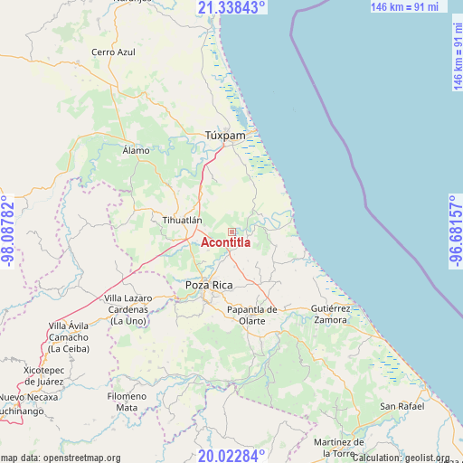
Acontitla GPS coordinates[2]
20° 40' 55.416" North, 97° 23' 4.884" West
| Map corner | latitude | longitude |
|---|---|---|
| Upper-left | 21.33843°, | -98.08782° |
| Center: | 20.68206°, | -97.38469° |
| Lower-right: | 20.02284°, | -96.68157° |
| Map W x H: | 146.3×146.3 km | = 90.9×90.9mi |
| max Lat: | 32.7° ⇑28.6% North |
| Acontitla: | 20.68206° |
| min Lat: | ⇓71.4% South 14.53588° |
| min Long | Acontitla | max Long |
| -117.105° | -97.38469° | -86.73105° |
| W 70.7%⇐ | ⇒29.3% E |
Elevation
Elevation of Acontitla is 21 m = 69 ft, and this is 1232.7 m = 4044 ft below average elevation for this country.
| Max E: |
3497 m = 11473 ft | 91.2% |
| Avg. | 1253.7 m = 4113 ft | |
| Acontitla | 21 m = 69 ft | |
Min E: |
-1 m = -3 ft | 8.8% |
See also: Mexico elevation on elevation.city.
Geographical zone
Acontitla is located in North Torrid zone (between Equator and Tropic of Cancer). Distance of this Northern Tropic circle is 306.3 km =190.3 mi to North.| Distance of | km | miles | from Acontitla |
|---|---|---|---|
| North Pole | 7707.4 | 4789.2 | to North |
| Arctic Circle | 5101.5 | 3169.9 | to North |
| Tropic Cancer | 306.3 | 190.3 | to North |
| Equator | 2299.6 | 1428.9 | to South |


Nearby cities:
15 places around Acontitla: (largest is in red/bold)
• Barrio Acosta Lagunes
7.4 km =4.6 mi,  79°
79°
• Cabellal Número Uno
6.3 km =3.9 mi,  96°
96°
• Caristay
9.2 km =5.7 mi,  116°
116°
• Cazones de Herrera
8.2 km =5.1 mi,  72°
72°
• Chichimantla Segundo
9 km =5.6 mi,  285°
285°
• El Palmar
9.7 km =6 mi,  209°
209°
• El Sauce
6.4 km =4 mi,  37°
37°
• El Águila
9.4 km =5.8 mi,  232°
232°
• La Concepción
4.2 km =2.6 mi,  204°
204°
• La Piedad
3.5 km =2.2 mi,  105°
105°
• Laja del Tubo
9.4 km =5.8 mi,  0°
0°
• Manlio Fabio Altamirano
9.8 km =6.1 mi, 42°
• Nuevo Tejamanil
4.6 km =2.9 mi,  349°
349°
• Paso del Pital
6.5 km =4 mi, 208°
• Residencial Tajín
9.9 km =6.2 mi, 199°
Sources, notices
• [Note1] Compared only with cities in Mexico existing in our database
• [Src1] Map data: © OpenStreetMap contributors (CC-BY-SA)
• [Src2] Other city data from geonames.org with taken over terms of usage.
• [Src3] Geographical zone / Annual Mean Temperature by Robert A. Rohde @ Wikipedia
