La Luz geodata
La Luz (Tabasco) is a populated place; located in Mexico in America/Mexico_City (GMT-6) time zone. With population of 578 people, there are 14828 cities with bigger population in this country. Compared to other cities in Mexico, 80.4% of cities are located further ↑North; 86.7% of cities are located further ←West and 86.5% of cities have higher elevation than La Luz. Note1


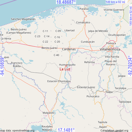
La Luz GPS coordinates[2]
17° 49' 7.464" North, 93° 24' 19.656" West
| Map corner | latitude | longitude |
|---|---|---|
| Upper-left | 18.48687°, | -94.10859° |
| Center: | 17.81874°, | -93.40546° |
| Lower-right: | 17.1481°, | -92.70234° |
| Map W x H: | 148.9×148.9 km | = 92.5×92.5mi |
| max Lat: | 32.7° ⇑80.4% North |
| La Luz: | 17.81874° |
| min Lat: | ⇓19.6% South 14.53588° |
| min Long | La Luz | max Long |
| -117.105° | -93.40546° | -86.73105° |
| W 86.7%⇐ | ⇒13.3% E |
Elevation
Elevation of La Luz is 36 m = 118 ft, and this is 1217.7 m = 3995 ft below average elevation for this country.
| Max E: |
3497 m = 11473 ft | 86.5% |
| Avg. | 1253.7 m = 4113 ft | |
| La Luz | 36 m = 118 ft | |
Min E: |
-1 m = -3 ft | 13.5% |
See also: Mexico elevation on elevation.city.
Geographical zone
La Luz is located in North Torrid zone (between Equator and Tropic of Cancer). Distance of this Northern Tropic circle is 624.7 km =388.2 mi to North.| Distance of | km | miles | from La Luz |
|---|---|---|---|
| North Pole | 8025.8 | 4987 | to North |
| Arctic Circle | 5419.9 | 3367.8 | to North |
| Tropic Cancer | 624.7 | 388.2 | to North |
| Equator | 1981.3 | 1231.1 | to South |


Nearby cities:
15 places around La Luz: (largest is in red/bold)
• Allende 1ra. Sección
12.5 km =7.8 mi,  151°
151°
• Benito Juárez (La Playita)
13.3 km =8.3 mi,  18°
18°
• C-41 (Licenciado Carlos A. Madrazo)
12.4 km =7.7 mi,  338°
338°
• Chicoacán
10.2 km =6.3 mi,  232°
232°
• Chicoacán (Ampliación)
8.6 km =5.3 mi,  215°
215°
• El Dorado
8.2 km =5.1 mi,  29°
29°
• El Limoncito
10.4 km =6.5 mi,  46°
46°
• Huimanguillo
2.4 km =1.5 mi, 45°
• La Península
14.6 km =9.1 mi, 18°
• Libertad
2.1 km =1.3 mi,  320°
320°
• Los Naranjos 1ra. Sección (Campechito)
13.1 km =8.1 mi, 19°
• Los Naranjos 2da. Sección
6.8 km =4.2 mi, 20°
• Mecatepec
14.9 km =9.3 mi,  302°
302°
• Ocuapan
9.8 km =6.1 mi,  293°
293°
• Paredón 3ra. Sección
14.3 km =8.9 mi,  167°
167°
Sources, notices
• [Note1] Compared only with cities in Mexico existing in our database
• [Src1] Map data: © OpenStreetMap contributors (CC-BY-SA)
• [Src2] Other city data from geonames.org with taken over terms of usage.
• [Src3] Geographical zone / Annual Mean Temperature by Robert A. Rohde @ Wikipedia
