Vinoté geodata
Vinoté (Chiapas) is a populated place; located in Mexico in America/Mexico_City (GMT-6) time zone. With population of 577 people, there are 14851 cities with bigger population in this country. Compared to other cities in Mexico, 87.1% of cities are located further ↑North; 91.8% of cities are located further ←West and 60.7% of cities have higher elevation than Vinoté. Note1


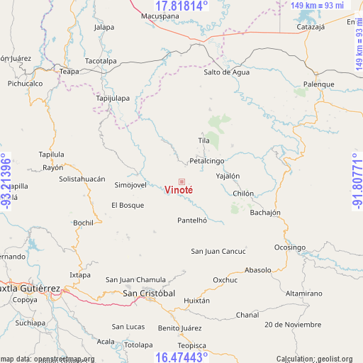
Vinoté GPS coordinates[2]
17° 8' 51" North, 92° 30' 38.988" West
| Map corner | latitude | longitude |
|---|---|---|
| Upper-left | 17.81814°, | -93.21396° |
| Center: | 17.1475°, | -92.51083° |
| Lower-right: | 16.47443°, | -91.80771° |
| Map W x H: | 149.4×149.4 km | = 92.8×92.8mi |
| max Lat: | 32.7° ⇑87.1% North |
| Vinoté: | 17.1475° |
| min Lat: | ⇓12.9% South 14.53588° |
| min Long | Vinoté | max Long |
| -117.105° | -92.51083° | -86.73105° |
| W 91.8%⇐ | ⇒8.2% E |
Elevation
Elevation of Vinoté is 957 m = 3140 ft, and this is 296.7 m = 973 ft below average elevation for this country.
| Max E: |
3497 m = 11473 ft | 60.7% |
| Avg. | 1253.7 m = 4113 ft | |
| Vinoté | 957 m = 3140 ft | |
Min E: |
-1 m = -3 ft | 39.3% |
See also: Mexico elevation on elevation.city.
Geographical zone
Vinoté is located in North Torrid zone (between Equator and Tropic of Cancer). Distance of this Northern Tropic circle is 699.3 km =434.5 mi to North.| Distance of | km | miles | from Vinoté |
|---|---|---|---|
| North Pole | 8100.4 | 5033.4 | to North |
| Arctic Circle | 5494.6 | 3414.2 | to North |
| Tropic Cancer | 699.3 | 434.5 | to North |
| Equator | 1906.6 | 1184.7 | to South |


Nearby cities:
15 places around Vinoté: (largest is in red/bold)
• Aurora Esquipulas
5 km =3.1 mi,  132°
132°
• Buenavista
8.8 km =5.5 mi,  349°
349°
• Constitución
8.1 km =5 mi,  190°
190°
• El Calvario
9.2 km =5.7 mi,  327°
327°
• El Jardín
9.6 km =6 mi,  282°
282°
• El Roblar Chishtontic
9.2 km =5.7 mi,  173°
173°
• Emiliano Zapata
9.8 km =6.1 mi,  91°
91°
• Joljá
6.5 km =4 mi,  10°
10°
• José Castillo Tielemans
2 km =1.2 mi,  261°
261°
• La Ceiba
1.8 km =1.1 mi,  209°
209°
• Las Mercedes Esperanza
6.1 km =3.8 mi,  231°
231°
• Maravillas
5.1 km =3.2 mi, 256°
• Nuevo Sitalá
3.1 km =1.9 mi,  106°
106°
• San Antonio Nuevo León
4.5 km =2.8 mi,  285°
285°
• Shoctic
8.8 km =5.5 mi,  15°
15°
Sources, notices
• [Note1] Compared only with cities in Mexico existing in our database
• [Src1] Map data: © OpenStreetMap contributors (CC-BY-SA)
• [Src2] Other city data from geonames.org with taken over terms of usage.
• [Src3] Geographical zone / Annual Mean Temperature by Robert A. Rohde @ Wikipedia
