El Calvario geodata
El Calvario (Chiapas) is a populated place; located in Mexico in America/Mexico_City (GMT-6) time zone. With population of 1,262 people, there are 6862 cities with bigger population in this country. Compared to other cities in Mexico, 86.3% of cities are located further ↑North; 91.4% of cities are located further ←West and 60.4% of cities have higher elevation than El Calvario. Note1


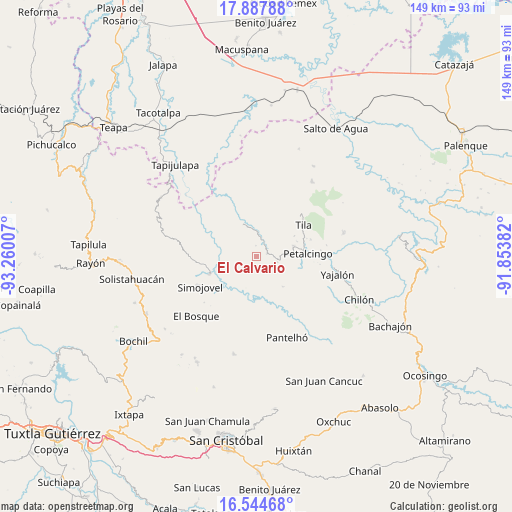
El Calvario GPS coordinates[2]
17° 13' 3" North, 92° 33' 24.984" West
| Map corner | latitude | longitude |
|---|---|---|
| Upper-left | 17.88788°, | -93.26007° |
| Center: | 17.2175°, | -92.55694° |
| Lower-right: | 16.54468°, | -91.85382° |
| Map W x H: | 149.3×149.4 km | = 92.8×92.8mi |
| max Lat: | 32.7° ⇑86.3% North |
| El Calvario: | 17.2175° |
| min Lat: | ⇓13.7% South 14.53588° |
| min Long | El Calvario | max Long |
| -117.105° | -92.55694° | -86.73105° |
| W 91.4%⇐ | ⇒8.6% E |
Elevation
Elevation of El Calvario is 980 m = 3215 ft, and this is 273.7 m = 898 ft below average elevation for this country.
| Max E: |
3497 m = 11473 ft | 60.4% |
| Avg. | 1253.7 m = 4113 ft | |
| El Calvario | 980 m = 3215 ft | |
Min E: |
-1 m = -3 ft | 39.6% |
See also: Mexico elevation on elevation.city.
Geographical zone
El Calvario is located in North Torrid zone (between Equator and Tropic of Cancer). Distance of this Northern Tropic circle is 691.5 km =429.7 mi to North.| Distance of | km | miles | from El Calvario |
|---|---|---|---|
| North Pole | 8092.7 | 5028.6 | to North |
| Arctic Circle | 5486.8 | 3409.3 | to North |
| Tropic Cancer | 691.5 | 429.7 | to North |
| Equator | 1914.4 | 1189.6 | to South |


Nearby cities:
15 places around El Calvario: (largest is in red/bold)
• Asunción Huitiupan
2.1 km =1.3 mi,  304°
304°
• Buenavista
3.3 km =2.1 mi,  74°
74°
• Chinintié
7.3 km =4.5 mi,  63°
63°
• El Jardín
7.2 km =4.5 mi,  218°
218°
• El Ocotal
9.1 km =5.7 mi,  38°
38°
• El Paraíso
3.2 km =2 mi,  0°
0°
• Joljá
6.3 km =3.9 mi,  103°
103°
• José Castillo Tielemans
8.6 km =5.3 mi,  159°
159°
• Los Naranjos
8.5 km =5.3 mi,  308°
308°
• Lázaro Cárdenas
4 km =2.5 mi,  277°
277°
• Maravillas
9 km =5.6 mi,  180°
180°
• Sabanilla
7.4 km =4.6 mi, 3°
• San Antonio Nuevo León
6.6 km =4.1 mi, 175°
• Shoctic
7.3 km =4.5 mi,  84°
84°
• Vinoté
9.2 km =5.7 mi,  147°
147°
Sources, notices
• [Note1] Compared only with cities in Mexico existing in our database
• [Src1] Map data: © OpenStreetMap contributors (CC-BY-SA)
• [Src2] Other city data from geonames.org with taken over terms of usage.
• [Src3] Geographical zone / Annual Mean Temperature by Robert A. Rohde @ Wikipedia
