San Miguel geodata
San Miguel (Oaxaca) is a populated place; located in Mexico in America/Mexico_City (GMT-6) time zone. With population of 567 people, there are 15067 cities with bigger population in this country. Compared to other cities in Mexico, 90.9% of cities are located further ↑North; 83.3% of cities are located further ←West and 68.9% of cities have higher elevation than San Miguel. Note1


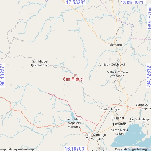
San Miguel GPS coordinates[2]
16° 51' 39.996" North, 95° 25' 45.984" West
| Map corner | latitude | longitude |
|---|---|---|
| Upper-left | 17.5328°, | -96.13257° |
| Center: | 16.86111°, | -95.42944° |
| Lower-right: | 16.18703°, | -94.72632° |
| Map W x H: | 149.6×149.6 km | = 93×93mi |
| max Lat: | 32.7° ⇑90.9% North |
| San Miguel: | 16.86111° |
| min Lat: | ⇓9.1% South 14.53588° |
| min Long | San Miguel | max Long |
| -117.105° | -95.42944° | -86.73105° |
| W 83.3%⇐ | ⇒16.7% E |
Elevation
Elevation of San Miguel is 472 m = 1549 ft, and this is 781.7 m = 2565 ft below average elevation for this country.
| Max E: |
3497 m = 11473 ft | 68.9% |
| Avg. | 1253.7 m = 4113 ft | |
| San Miguel | 472 m = 1549 ft | |
Min E: |
-1 m = -3 ft | 31.1% |
See also: Mexico elevation on elevation.city.
Geographical zone
San Miguel is located in North Torrid zone (between Equator and Tropic of Cancer). Distance of this Northern Tropic circle is 731.1 km =454.3 mi to North.| Distance of | km | miles | from San Miguel |
|---|---|---|---|
| North Pole | 8132.3 | 5053.2 | to North |
| Arctic Circle | 5526.4 | 3433.9 | to North |
| Tropic Cancer | 731.1 | 454.3 | to North |
| Equator | 1874.8 | 1164.9 | to South |


Nearby cities:
15 places around San Miguel: (largest is in red/bold)
• Guadalupe Guevea
18.1 km =11.2 mi,  222°
222°
• Guigovelaga
3.5 km =2.2 mi,  305°
305°
• Loma Santa Cruz
18.1 km =11.2 mi,  38°
38°
• San Juan Mazatlán
18.8 km =11.7 mi,  354°
354°
• San Pedro Acatlán Grande
23.1 km =14.4 mi,  335°
335°
• San Pedro Chimaltepec
28.7 km =17.8 mi,  301°
301°
• Santa Margarita Huitepec
26.9 km =16.7 mi,  288°
288°
• Santa María Guenagati
15.8 km =9.8 mi,  149°
149°
• Santa María Nativitas Coatlán
10.7 km =6.6 mi,  267°
267°
• Santiago Ixcuintepec
22.2 km =13.8 mi, 291°
• Santiago Lachiguiri
22.2 km =13.8 mi,  209°
209°
• Santiago Malacatepec
25.6 km =15.9 mi, 312°
• Santiago Quiavicuzas
30.5 km =19 mi, 270°
• Santo Domingo Petapa
31.1 km =19.3 mi,  98°
98°
• Zacatal
25.6 km =15.9 mi,  70°
70°
Sources, notices
• [Note1] Compared only with cities in Mexico existing in our database
• [Src1] Map data: © OpenStreetMap contributors (CC-BY-SA)
• [Src2] Other city data from geonames.org with taken over terms of usage.
• [Src3] Geographical zone / Annual Mean Temperature by Robert A. Rohde @ Wikipedia
