Guadalupe Guevea geodata
Guadalupe Guevea (Oaxaca) is a populated place; located in Mexico in America/Mexico_City (GMT-6) time zone. With population of 512 people, there are 16417 cities with bigger population in this country. Compared to other cities in Mexico, 92.4% of cities are located further ↑North; 83.1% of cities are located further ←West and 59.2% of cities have higher elevation than Guadalupe Guevea. Note1


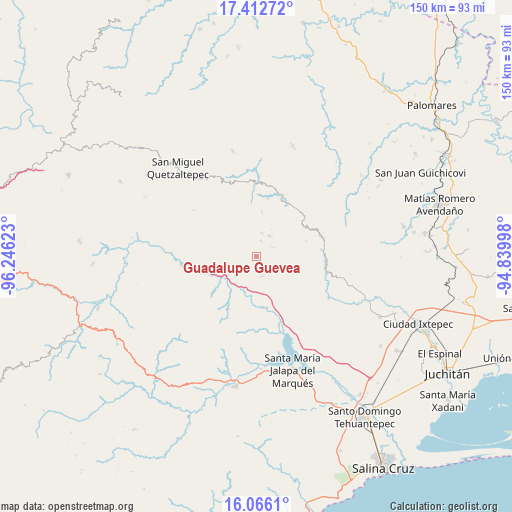
Guadalupe Guevea GPS coordinates[2]
16° 44' 26.16" North, 95° 32' 35.16" West
| Map corner | latitude | longitude |
|---|---|---|
| Upper-left | 17.41272°, | -96.24623° |
| Center: | 16.7406°, | -95.5431° |
| Lower-right: | 16.0661°, | -94.83998° |
| Map W x H: | 149.7×149.7 km | = 93×93mi |
| max Lat: | 32.7° ⇑92.4% North |
| Guadalupe Guevea: | 16.7406° |
| min Lat: | ⇓7.6% South 14.53588° |
| min Long | Guadalupe Gueve | max Long |
| -117.105° | -95.5431° | -86.73105° |
| W 83.1%⇐ | ⇒16.9% E |
Elevation
Elevation of Guadalupe Guevea is 1040 m = 3412 ft, and this is 213.7 m = 701 ft below average elevation for this country.
| Max E: |
3497 m = 11473 ft | 59.2% |
| Avg. | 1253.7 m = 4113 ft | |
| Guadalupe Guevea | 1040 m = 3412 ft | |
Min E: |
-1 m = -3 ft | 40.8% |
See also: Mexico elevation on elevation.city.
Geographical zone
Guadalupe Guevea is located in North Torrid zone (between Equator and Tropic of Cancer). Distance of this Northern Tropic circle is 744.5 km =462.6 mi to North.| Distance of | km | miles | from Guadalupe Guevea |
|---|---|---|---|
| North Pole | 8145.7 | 5061.5 | to North |
| Arctic Circle | 5539.8 | 3442.3 | to North |
| Tropic Cancer | 744.5 | 462.6 | to North |
| Equator | 1861.4 | 1156.6 | to South |


Nearby cities:
15 places around Guadalupe Guevea: (largest is in red/bold)
• Guigovelaga
18 km =11.2 mi,  30°
30°
• Jalapa
28 km =17.4 mi,  163°
163°
• San Cristóbal
32.9 km =20.4 mi,  177°
177°
• San Juan Mazatlán
33.8 km =21 mi,  17°
17°
• San Lucas Camotlán
29.1 km =18.1 mi,  321°
321°
• San Miguel
18.1 km =11.2 mi,  42°
42°
• San Pedro Chimaltepec
31 km =19.3 mi,  336°
336°
• Santa Margarita Huitepec
25.8 km =16 mi,  328°
328°
• Santa María Guenagati
20.1 km =12.5 mi,  90°
90°
• Santa María Nativitas Coatlán
13 km =8.1 mi,  6°
6°
• Santa María Totolapilla
17.8 km =11.1 mi,  209°
209°
• Santiago Ixcuintepec
23.3 km =14.5 mi, 338°
• Santiago Lachiguiri
6.1 km =3.8 mi,  167°
167°
• Santiago Malacatepec
31.4 km =19.5 mi,  347°
347°
• Santiago Quiavicuzas
22.9 km =14.2 mi,  306°
306°
Sources, notices
• [Note1] Compared only with cities in Mexico existing in our database
• [Src1] Map data: © OpenStreetMap contributors (CC-BY-SA)
• [Src2] Other city data from geonames.org with taken over terms of usage.
• [Src3] Geographical zone / Annual Mean Temperature by Robert A. Rohde @ Wikipedia
