Fracción la Angostura Norte geodata
Fracción la Angostura Norte (San Luis Potosí) is a populated place; located in Mexico in America/Mexico_City (GMT-6) time zone. With population of 561 people, there are 15205 cities with bigger population in this country. Compared to other cities in Mexico, 85.2% of cities are located further ↓South; 73.5% of cities are located further →East and 67.9% of cities have lower elevation than Fracción la Angostura Norte. Note1
Current local time in Fracción la Angostura Norte:
06:50 AM, WednesdayDifference from your time zone: hours


Fracción la Angostura Norte GPS coordinates[2]
22° 12' 34.992" North, 101° 0' 15.012" West
| Map corner | latitude | longitude |
|---|---|---|
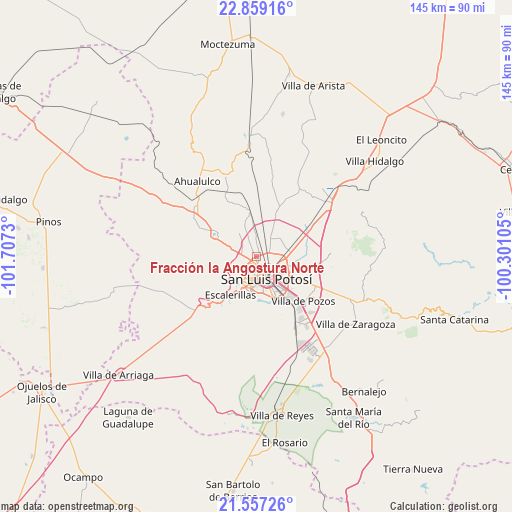
| Upper-left | 22.85916°, | -101.7073° |
| Center: | 22.20972°, | -101.00417° |
| Lower-right: | 21.55726°, | -100.30105° |
| Map W x H: | 144.8×144.8 km | = 90×90mi |
| max Lat: | 32.7° ⇑14.8% North |
| Fracción la Angostura Norte: | 22.20972° |
| min Lat: | ⇓85.2% South 14.53588° |
| min Long | Fracción la An | max Long |
| -117.105° | -101.00417° | -86.73105° |
| W 26.5%⇐ | ⇒73.5% E |
Elevation
Elevation of Fracción la Angostura Norte is 1887 m = 6191 ft, and this is 633.3 m = 2078 ft above average elevation for this country.
| Max E: |
3497 m = 11473 ft | 32.1% |
| Fracción la Angostura Norte | 1887 m 6191 ft | |
| Avg. | 1253.7 m = 4113 ft | |
Min E: |
-1 m = -3 ft | 67.9% |
See also: Mexico elevation on elevation.city.
Geographical zone
Fracción la Angostura Norte is located in North Torrid zone (between Equator and Tropic of Cancer). Distance of this Northern Tropic circle is 136.4 km =84.8 mi to North.| Distance of | km | miles | from Fracción la Angostura Norte |
|---|---|---|---|
| North Pole | 7537.6 | 4683.6 | to North |
| Arctic Circle | 4931.7 | 3064.4 | to North |
| Tropic Cancer | 136.4 | 84.8 | to North |
| Equator | 2469.5 | 1534.5 | to South |


Nearby cities:
15 places around Fracción la Angostura Norte: (largest is in red/bold)
• Agua Señora
5 km =3.1 mi,  308°
308°
• Capulines
6 km =3.7 mi,  232°
232°
• Cerrito de Jaral
6.2 km =3.9 mi,  284°
284°
• Cerrito de Maravillas
4.8 km =3 mi,  334°
334°
• Colorada
4.1 km =2.5 mi, 334°
• El Jaralito
4.7 km =2.9 mi,  256°
256°
• Estanzuela
6.6 km =4.1 mi,  356°
356°
• Fracción Milpillas
4.6 km =2.9 mi,  64°
64°
• La Loma
4.8 km =3 mi, 275°
• Los Moreno
4.9 km =3 mi, 358°
• Maravillas
3.3 km =2.1 mi,  348°
348°
• Monte Obscuro
2.8 km =1.7 mi,  293°
293°
• Paisanos
3.3 km =2.1 mi, 258°
• Paso Blanco
6.8 km =4.2 mi,  266°
266°
• San Luis Potosí
7.1 km =4.4 mi,  158°
158°
Sources, notices
• [Note1] Compared only with cities in Mexico existing in our database
• [Src1] Map data: © OpenStreetMap contributors (CC-BY-SA)
• [Src2] Other city data from geonames.org with taken over terms of usage.
• [Src3] Geographical zone / Annual Mean Temperature by Robert A. Rohde @ Wikipedia
