Cristo Rey geodata
Cristo Rey (Guanajuato) is a populated place; located in Mexico in America/Mexico_City (GMT-6) time zone. With population of 557 people, there are 15314 cities with bigger population in this country. Compared to other cities in Mexico, 78% of cities are located further ↓South; 78% of cities are located further →East and 66% of cities have lower elevation than Cristo Rey. Note1


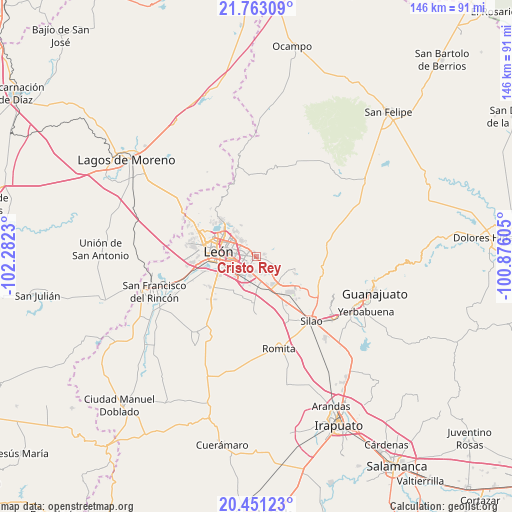
Cristo Rey GPS coordinates[2]
21° 6' 30.996" North, 101° 34' 45.012" West
| Map corner | latitude | longitude |
|---|---|---|
| Upper-left | 21.76309°, | -102.2823° |
| Center: | 21.10861°, | -101.57917° |
| Lower-right: | 20.45123°, | -100.87605° |
| Map W x H: | 145.9×145.9 km | = 90.7×90.7mi |
| max Lat: | 32.7° ⇑22% North |
| Cristo Rey: | 21.10861° |
| min Lat: | ⇓78% South 14.53588° |
| min Long | Cristo Rey | max Long |
| -117.105° | -101.57917° | -86.73105° |
| W 22%⇐ | ⇒78% E |
Elevation
Elevation of Cristo Rey is 1852 m = 6076 ft, and this is 598.3 m = 1963 ft above average elevation for this country.
| Max E: |
3497 m = 11473 ft | 34% |
| Cristo Rey | 1852 m 6076 ft | |
| Avg. | 1253.7 m = 4113 ft | |
Min E: |
-1 m = -3 ft | 66% |
See also: Mexico elevation on elevation.city.
Geographical zone
Cristo Rey is located in North Torrid zone (between Equator and Tropic of Cancer). Distance of this Northern Tropic circle is 258.9 km =160.9 mi to North.| Distance of | km | miles | from Cristo Rey |
|---|---|---|---|
| North Pole | 7660 | 4759.7 | to North |
| Arctic Circle | 5054.1 | 3140.5 | to North |
| Tropic Cancer | 258.9 | 160.9 | to North |
| Equator | 2347.1 | 1458.4 | to South |


Nearby cities:
15 places around Cristo Rey: (largest is in red/bold)
• Alfaro
5.3 km =3.3 mi,  328°
328°
• Arboledas de los López Primera Sección
7 km =4.3 mi,  184°
184°
• Duarte
6.2 km =3.9 mi,  112°
112°
• Fraccionamiento Paraíso Real
0.5 km =0.3 mi,  338°
338°
• La Laborcita
2.9 km =1.8 mi,  95°
95°
• Ladrilleras del Refugio
3.8 km =2.4 mi,  135°
135°
• Las Coloradas
8 km =5 mi, 98°
• Lomas de la Loza
5.7 km =3.5 mi,  152°
152°
• Loza de los Padres
5.3 km =3.3 mi, 139°
• Lucio Blanco (Los Gavilanes)
3 km =1.9 mi,  75°
75°
• Medina
6.4 km =4 mi,  315°
315°
• Nueva Colonia San Carlos
6.8 km =4.2 mi,  192°
192°
• San José del Potrero
2.9 km =1.8 mi, 319°
• San Juan de Abajo
8.2 km =5.1 mi,  225°
225°
• San Juan de Otates
2.4 km =1.5 mi,  70°
70°
Sources, notices
• [Note1] Compared only with cities in Mexico existing in our database
• [Src1] Map data: © OpenStreetMap contributors (CC-BY-SA)
• [Src2] Other city data from geonames.org with taken over terms of usage.
• [Src3] Geographical zone / Annual Mean Temperature by Robert A. Rohde @ Wikipedia
