Plan de Guadalupe geodata
Plan de Guadalupe (Oaxaca) is a populated place; located in Mexico in America/Mexico_City (GMT-6) time zone. With population of 556 people, there are 15345 cities with bigger population in this country. Compared to other cities in Mexico, 86.4% of cities are located further ↑North; 66.2% of cities are located further ←West and 80.7% of cities have lower elevation than Plan de Guadalupe. Note1


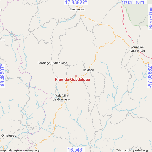
Plan de Guadalupe GPS coordinates[2]
17° 12' 56.988" North, 97° 47' 30.984" West
| Map corner | latitude | longitude |
|---|---|---|
| Upper-left | 17.88622°, | -98.49507° |
| Center: | 17.21583°, | -97.79194° |
| Lower-right: | 16.543°, | -97.08882° |
| Map W x H: | 149.4×149.4 km | = 92.8×92.8mi |
| max Lat: | 32.7° ⇑86.4% North |
| Plan de Guadalupe: | 17.21583° |
| min Lat: | ⇓13.6% South 14.53588° |
| min Long | Plan de Guadalu | max Long |
| -117.105° | -97.79194° | -86.73105° |
| W 66.2%⇐ | ⇒33.8% E |
Elevation
Elevation of Plan de Guadalupe is 2158 m = 7080 ft, and this is 904.3 m = 2967 ft above average elevation for this country.
| Max E: |
3497 m = 11473 ft | 19.3% |
| Plan de Guadalupe | 2158 m 7080 ft | |
| Avg. | 1253.7 m = 4113 ft | |
Min E: |
-1 m = -3 ft | 80.7% |
See also: Mexico elevation on elevation.city.
Geographical zone
Plan de Guadalupe is located in North Torrid zone (between Equator and Tropic of Cancer). Distance of this Northern Tropic circle is 691.7 km =429.8 mi to North.| Distance of | km | miles | from Plan de Guadalupe |
|---|---|---|---|
| North Pole | 8092.8 | 5028.6 | to North |
| Arctic Circle | 5487 | 3409.5 | to North |
| Tropic Cancer | 691.7 | 429.8 | to North |
| Equator | 1914.2 | 1189.4 | to South |


Nearby cities:
15 places around Plan de Guadalupe: (largest is in red/bold)
• Concepción Carrizal
12.7 km =7.9 mi,  237°
237°
• Diecinueve de Abril
9.2 km =5.7 mi,  173°
173°
• Heroica Ciudad de Tlaxiaco
13.2 km =8.2 mi,  63°
63°
• La Laguna Guadalupe
7.2 km =4.5 mi, 239°
• La Lobera
11.5 km =7.1 mi, 62°
• Los Ángeles
6 km =3.7 mi,  189°
189°
• Ojo de Agua
12.6 km =7.8 mi,  135°
135°
• San Andrés Chicahuaxtla
8.1 km =5 mi,  216°
216°
• San José Xochixtlán
3.1 km =1.9 mi, 243°
• San Juan Mixtepec
10.8 km =6.7 mi,  337°
337°
• San Martín Itunyoso
9.5 km =5.9 mi,  278°
278°
• Santa Cruz Nundaco
8.8 km =5.5 mi,  124°
124°
• Santa María Yucunicoco
13.5 km =8.4 mi, 280°
• Santo Domingo del Estado
8.9 km =5.5 mi, 221°
• Yosobee
11 km =6.8 mi,  73°
73°
Sources, notices
• [Note1] Compared only with cities in Mexico existing in our database
• [Src1] Map data: © OpenStreetMap contributors (CC-BY-SA)
• [Src2] Other city data from geonames.org with taken over terms of usage.
• [Src3] Geographical zone / Annual Mean Temperature by Robert A. Rohde @ Wikipedia
