Yosobee geodata
Yosobee (Oaxaca) is a populated place; located in Mexico in America/Mexico_City (GMT-6) time zone. With population of 802 people, there are 10884 cities with bigger population in this country. Compared to other cities in Mexico, 86% of cities are located further ↑North; 67.3% of cities are located further ←West and 76.3% of cities have lower elevation than Yosobee. Note1


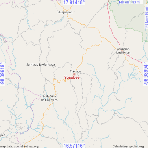
Yosobee GPS coordinates[2]
17° 14' 38.004" North, 97° 41' 35.016" West
| Map corner | latitude | longitude |
|---|---|---|
| Upper-left | 17.91418°, | -98.39619° |
| Center: | 17.24389°, | -97.69306° |
| Lower-right: | 16.57116°, | -96.98994° |
| Map W x H: | 149.3×149.3 km | = 92.8×92.8mi |
| max Lat: | 32.7° ⇑86% North |
| Yosobee: | 17.24389° |
| min Lat: | ⇓14% South 14.53588° |
| min Long | Yosobee | max Long |
| -117.105° | -97.69306° | -86.73105° |
| W 67.3%⇐ | ⇒32.7% E |
Elevation
Elevation of Yosobee is 2054 m = 6739 ft, and this is 800.3 m = 2626 ft above average elevation for this country.
| Max E: |
3497 m = 11473 ft | 23.7% |
| Yosobee | 2054 m 6739 ft | |
| Avg. | 1253.7 m = 4113 ft | |
Min E: |
-1 m = -3 ft | 76.3% |
See also: Mexico elevation on elevation.city.
Geographical zone
Yosobee is located in North Torrid zone (between Equator and Tropic of Cancer). Distance of this Northern Tropic circle is 688.6 km =427.9 mi to North.| Distance of | km | miles | from Yosobee |
|---|---|---|---|
| North Pole | 8089.7 | 5026.7 | to North |
| Arctic Circle | 5483.8 | 3407.5 | to North |
| Tropic Cancer | 688.6 | 427.9 | to North |
| Equator | 1917.3 | 1191.4 | to South |


Nearby cities:
15 places around Yosobee: (largest is in red/bold)
• Barrio San Diego
4.4 km =2.7 mi,  27°
27°
• Colonia Adolfo López Mateos
6.3 km =3.9 mi,  21°
21°
• Diecinueve de Abril
15.4 km =9.6 mi,  217°
217°
• Heroica Ciudad de Tlaxiaco
3.1 km =1.9 mi, 25°
• La Lobera
2.3 km =1.4 mi,  350°
350°
• Llano de Guadalupe
11.3 km =7 mi,  138°
138°
• Los Ángeles
14.6 km =9.1 mi,  231°
231°
• Ojo de Agua
12.2 km =7.6 mi,  188°
188°
• Plan de Guadalupe
11 km =6.8 mi,  253°
253°
• San Cristóbal Amoltepec
13.6 km =8.5 mi,  70°
70°
• San Isidro
13.3 km =8.3 mi,  103°
103°
• San José Xochixtlán
14 km =8.7 mi, 251°
• San Pedro Ñumí
15 km =9.3 mi,  9°
9°
• Santa Cruz Nundaco
8.7 km =5.4 mi,  201°
201°
• Santiago Nundíche
9.9 km =6.2 mi, 11°
Sources, notices
• [Note1] Compared only with cities in Mexico existing in our database
• [Src1] Map data: © OpenStreetMap contributors (CC-BY-SA)
• [Src2] Other city data from geonames.org with taken over terms of usage.
• [Src3] Geographical zone / Annual Mean Temperature by Robert A. Rohde @ Wikipedia
