El Bayo 2da. Sección geodata
El Bayo 2da. Sección (Tabasco) is a populated place; located in Mexico in America/Mexico_City (GMT-6) time zone. With population of 552 people, there are 15449 cities with bigger population in this country. Compared to other cities in Mexico, 79.9% of cities are located further ↑North; 92.1% of cities are located further ←West and 97.5% of cities have higher elevation than El Bayo 2da. Sección. Note1
Current local time in El Bayo 2da. Sección:
05:32 AM, WednesdayDifference from your time zone: hours


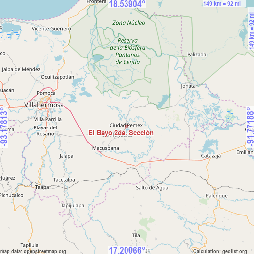
El Bayo 2da. Sección GPS coordinates[2]
17° 52' 15.996" North, 92° 28' 30" West
| Map corner | latitude | longitude |
|---|---|---|
| Upper-left | 18.53904°, | -93.17813° |
| Center: | 17.87111°, | -92.475° |
| Lower-right: | 17.20066°, | -91.77188° |
| Map W x H: | 148.8×148.8 km | = 92.5×92.5mi |
| max Lat: | 32.7° ⇑79.9% North |
| El Bayo 2da. Sección: | 17.87111° |
| min Lat: | ⇓20.1% South 14.53588° |
| min Long | El Bayo 2da. Se | max Long |
| -117.105° | -92.475° | -86.73105° |
| W 92.1%⇐ | ⇒7.9% E |
Elevation
Elevation of El Bayo 2da. Sección is 9 m = 30 ft, and this is 1244.7 m = 4084 ft below average elevation for this country.
| Max E: |
3497 m = 11473 ft | 97.5% |
| Avg. | 1253.7 m = 4113 ft | |
| El Bayo 2da. Sección | 9 m = 30 ft | |
Min E: |
-1 m = -3 ft | 2.5% |
See also: Mexico elevation on elevation.city.
Geographical zone
El Bayo 2da. Sección is located in North Torrid zone (between Equator and Tropic of Cancer). Distance of this Northern Tropic circle is 618.8 km =384.5 mi to North.| Distance of | km | miles | from El Bayo 2da. Sección |
|---|---|---|---|
| North Pole | 8020 | 4983.4 | to North |
| Arctic Circle | 5414.1 | 3364.2 | to North |
| Tropic Cancer | 618.8 | 384.5 | to North |
| Equator | 1987.1 | 1234.7 | to South |


Nearby cities:
15 places around El Bayo 2da. Sección: (largest is in red/bold)
• Aquiles Serdán (San Fernando)
7.5 km =4.7 mi,  192°
192°
• Buenavista
8 km =5 mi,  309°
309°
• Cacahuatalillo
8.5 km =5.3 mi,  222°
222°
• Ciudad Pemex
1.6 km =1 mi,  323°
323°
• El Bayo 1ra. Sección (Granada)
4.5 km =2.8 mi,  209°
209°
• El Congo
6.4 km =4 mi,  143°
143°
• Hermenegildo Galeana (Chiveros)
1.4 km =0.9 mi,  29°
29°
• José Colomo
8.5 km =5.3 mi,  6°
6°
• La Curva
1.5 km =0.9 mi,  247°
247°
• La Escalera
6.2 km =3.9 mi,  240°
240°
• La Unión
3.4 km =2.1 mi, 221°
• Limón 1ra. Sección Sector B
3.1 km =1.9 mi, 313°
• Nueva División del Bayo (Guatemala)
3.8 km =2.4 mi,  203°
203°
• Nueva Esperanza
7.3 km =4.5 mi,  272°
272°
• San Carlos
7.2 km =4.5 mi,  234°
234°
Sources, notices
• [Note1] Compared only with cities in Mexico existing in our database
• [Src1] Map data: © OpenStreetMap contributors (CC-BY-SA)
• [Src2] Other city data from geonames.org with taken over terms of usage.
• [Src3] Geographical zone / Annual Mean Temperature by Robert A. Rohde @ Wikipedia
