Bramadero geodata
Bramadero (Oaxaca) is a populated place; located in Mexico in America/Mexico_City (GMT-6) time zone. With population of 547 people, there are 15556 cities with bigger population in this country. Compared to other cities in Mexico, 95.1% of cities are located further ↑North; 80.5% of cities are located further ←West and 57.7% of cities have lower elevation than Bramadero. Note1


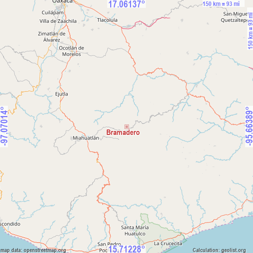
Bramadero GPS coordinates[2]
16° 23' 16.764" North, 96° 22' 1.236" West
| Map corner | latitude | longitude |
|---|---|---|
| Upper-left | 17.06137°, | -97.07014° |
| Center: | 16.38799°, | -96.36701° |
| Lower-right: | 15.71228°, | -95.66389° |
| Map W x H: | 150×150 km | = 93.2×93.2mi |
| max Lat: | 32.7° ⇑95.1% North |
| Bramadero: | 16.38799° |
| min Lat: | ⇓4.9% South 14.53588° |
| min Long | Bramadero | max Long |
| -117.105° | -96.36701° | -86.73105° |
| W 80.5%⇐ | ⇒19.5% E |
Elevation
Elevation of Bramadero is 1682 m = 5518 ft, and this is 428.3 m = 1405 ft above average elevation for this country.
| Max E: |
3497 m = 11473 ft | 42.3% |
| Bramadero | 1682 m 5518 ft | |
| Avg. | 1253.7 m = 4113 ft | |
Min E: |
-1 m = -3 ft | 57.7% |
See also: Mexico elevation on elevation.city.
Geographical zone
Bramadero is located in North Torrid zone (between Equator and Tropic of Cancer). Distance of this Northern Tropic circle is 783.7 km =487 mi to North.| Distance of | km | miles | from Bramadero |
|---|---|---|---|
| North Pole | 8184.9 | 5085.9 | to North |
| Arctic Circle | 5579 | 3466.6 | to North |
| Tropic Cancer | 783.7 | 487 | to North |
| Equator | 1822.2 | 1132.3 | to South |


Nearby cities:
15 places around Bramadero: (largest is in red/bold)
• El Costoche
3 km =1.9 mi,  300°
300°
• Nizagoche
4.2 km =2.6 mi,  34°
34°
• San Cristóbal Amatlán
9 km =5.6 mi,  208°
208°
• San Francisco Logueche
4 km =2.5 mi,  196°
196°
• San Ildefonso Amatlán
14.6 km =9.1 mi,  245°
245°
• San José Lachiguirí
3.5 km =2.2 mi,  108°
108°
• San Juan Mixtepec
14.2 km =8.8 mi,  150°
150°
• San Luis Amatlán
14 km =8.7 mi,  269°
269°
• San Pedro Amatlán
11.1 km =6.9 mi,  232°
232°
• San Pedro Mixtepec
15.8 km =9.8 mi, 145°
• San Pedro Mártir Quiechapa
13.4 km =8.3 mi,  76°
76°
• Santa Catalina Quieri
13.1 km =8.1 mi,  124°
124°
• Santa Catalina Quierí
13.1 km =8.1 mi,  125°
125°
• Santa Catarina Quioquitani
11.8 km =7.3 mi, 133°
• Yojuela
14.2 km =8.8 mi, 199°
Sources, notices
• [Note1] Compared only with cities in Mexico existing in our database
• [Src1] Map data: © OpenStreetMap contributors (CC-BY-SA)
• [Src2] Other city data from geonames.org with taken over terms of usage.
• [Src3] Geographical zone / Annual Mean Temperature by Robert A. Rohde @ Wikipedia
