San Jacinto geodata
San Jacinto (Puebla) is a populated place; located in Mexico in America/Mexico_City (GMT-6) time zone. With population of 531 people, there are 15939 cities with bigger population in this country. Compared to other cities in Mexico, 63.8% of cities are located further ↑North; 62.8% of cities are located further ←West and 87.2% of cities have lower elevation than San Jacinto. Note1


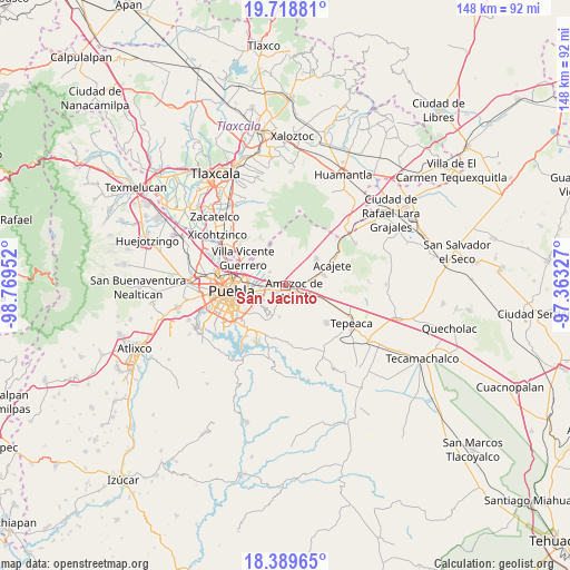
San Jacinto GPS coordinates[2]
19° 3' 20.016" North, 98° 3' 59.004" West
| Map corner | latitude | longitude |
|---|---|---|
| Upper-left | 19.71881°, | -98.76952° |
| Center: | 19.05556°, | -98.06639° |
| Lower-right: | 18.38965°, | -97.36327° |
| Map W x H: | 147.8×147.8 km | = 91.8×91.8mi |
| max Lat: | 32.7° ⇑63.8% North |
| San Jacinto: | 19.05556° |
| min Lat: | ⇓36.2% South 14.53588° |
| min Long | San Jacinto | max Long |
| -117.105° | -98.06639° | -86.73105° |
| W 62.8%⇐ | ⇒37.2% E |
Elevation
Elevation of San Jacinto is 2316 m = 7598 ft, and this is 1062.3 m = 3485 ft above average elevation for this country.
| Max E: |
3497 m = 11473 ft | 12.8% |
| San Jacinto | 2316 m 7598 ft | |
| Avg. | 1253.7 m = 4113 ft | |
Min E: |
-1 m = -3 ft | 87.2% |
See also: Mexico elevation on elevation.city.
Geographical zone
San Jacinto is located in North Torrid zone (between Equator and Tropic of Cancer). Distance of this Northern Tropic circle is 487.1 km =302.7 mi to North.| Distance of | km | miles | from San Jacinto |
|---|---|---|---|
| North Pole | 7888.3 | 4901.6 | to North |
| Arctic Circle | 5282.4 | 3282.3 | to North |
| Tropic Cancer | 487.1 | 302.7 | to North |
| Equator | 2118.8 | 1316.6 | to South |


Nearby cities:
15 places around San Jacinto: (largest is in red/bold)
• 6 de Junio
10.4 km =6.5 mi,  305°
305°
• Amozoc de Mota
2.5 km =1.6 mi,  115°
115°
• Casa Blanca
5.7 km =3.5 mi,  254°
254°
• Concepción Capulac (La Ex-Hacienda)
4.4 km =2.7 mi,  6°
6°
• Ignacio Zaragoza
0.8 km =0.5 mi,  114°
114°
• La Resurrección
8.5 km =5.3 mi, 308°
• Primero de Mayo
4.4 km =2.7 mi, 311°
• San Agustín Tlaxco
7.9 km =4.9 mi,  89°
89°
• San Martin
3.5 km =2.2 mi,  232°
232°
• San Miguel Espejo
4.4 km =2.7 mi,  359°
359°
• Santa Cruz Alpuyeca
8.4 km =5.2 mi,  190°
190°
• Santa María Nenetzintla
10.5 km =6.5 mi, 90°
• Santa María Xonacatepec
5.4 km =3.4 mi, 313°
• Signoret
2.6 km =1.6 mi,  273°
273°
• Tepatlaxco de Hidalgo
10.2 km =6.3 mi,  74°
74°
Sources, notices
• [Note1] Compared only with cities in Mexico existing in our database
• [Src1] Map data: © OpenStreetMap contributors (CC-BY-SA)
• [Src2] Other city data from geonames.org with taken over terms of usage.
• [Src3] Geographical zone / Annual Mean Temperature by Robert A. Rohde @ Wikipedia
