Santa Cruz Alpuyeca geodata
Santa Cruz Alpuyeca (Puebla) is a populated place; located in Mexico in America/Mexico_City (GMT-6) time zone. With population of 579 people, there are 14804 cities with bigger population in this country. Compared to other cities in Mexico, 65% of cities are located further ↑North; 62.7% of cities are located further ←West and 82.8% of cities have lower elevation than Santa Cruz Alpuyeca. Note1


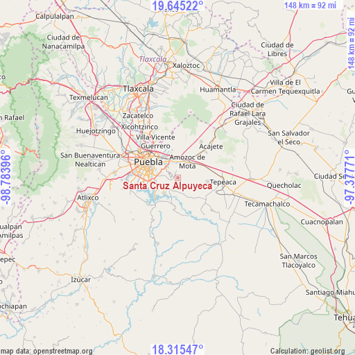
Santa Cruz Alpuyeca GPS coordinates[2]
18° 58' 54.012" North, 98° 4' 50.988" West
| Map corner | latitude | longitude |
|---|---|---|
| Upper-left | 19.64522°, | -98.78396° |
| Center: | 18.98167°, | -98.08083° |
| Lower-right: | 18.31547°, | -97.37771° |
| Map W x H: | 147.9×147.9 km | = 91.9×91.9mi |
| max Lat: | 32.7° ⇑65% North |
| Santa Cruz Alpuyeca: | 18.98167° |
| min Lat: | ⇓35% South 14.53588° |
| min Long | Santa Cruz Alpu | max Long |
| -117.105° | -98.08083° | -86.73105° |
| W 62.7%⇐ | ⇒37.3% E |
Elevation
Elevation of Santa Cruz Alpuyeca is 2209 m = 7247 ft, and this is 955.3 m = 3134 ft above average elevation for this country.
| Max E: |
3497 m = 11473 ft | 17.2% |
| Santa Cruz Alpuyeca | 2209 m 7247 ft | |
| Avg. | 1253.7 m = 4113 ft | |
Min E: |
-1 m = -3 ft | 82.8% |
See also: Mexico elevation on elevation.city.
Geographical zone
Santa Cruz Alpuyeca is located in North Torrid zone (between Equator and Tropic of Cancer). Distance of this Northern Tropic circle is 495.4 km =307.8 mi to North.| Distance of | km | miles | from Santa Cruz Alpuyeca |
|---|---|---|---|
| North Pole | 7896.5 | 4906.7 | to North |
| Arctic Circle | 5290.6 | 3287.4 | to North |
| Tropic Cancer | 495.4 | 307.8 | to North |
| Equator | 2110.6 | 1311.5 | to South |


Nearby cities:
15 places around Santa Cruz Alpuyeca: (largest is in red/bold)
• 18 de Marzo
8.5 km =5.3 mi,  260°
260°
• Alpatláhuac (San Pedro Alpatláhuac)
6.7 km =4.2 mi,  142°
142°
• Amozoc de Mota
8.1 km =5 mi,  27°
27°
• Artículo Primero Constitucional
8.2 km =5.1 mi, 264°
• Casa Blanca
7.8 km =4.8 mi,  329°
329°
• Cuautinchán
7.5 km =4.7 mi,  113°
113°
• Galaxia la Calera
7.8 km =4.8 mi,  284°
284°
• Guadalupe
8.3 km =5.2 mi,  251°
251°
• Ignacio Zaragoza
8.2 km =5.1 mi,  15°
15°
• San Jacinto
8.4 km =5.2 mi,  10°
10°
• San Jerónimo Almoloya
8.7 km =5.4 mi,  121°
121°
• San Juan Tepepa
7.8 km =4.8 mi, 263°
• San Martin
6.2 km =3.9 mi,  348°
348°
• Santo Tomás Chautla
7.8 km =4.8 mi, 256°
• Signoret
8.4 km =5.2 mi, 352°
Sources, notices
• [Note1] Compared only with cities in Mexico existing in our database
• [Src1] Map data: © OpenStreetMap contributors (CC-BY-SA)
• [Src2] Other city data from geonames.org with taken over terms of usage.
• [Src3] Geographical zone / Annual Mean Temperature by Robert A. Rohde @ Wikipedia
