La Providencia geodata
La Providencia (Veracruz) is a populated place; located in Mexico in America/Mexico_City (GMT-6) time zone. With population of 518 people, there are 16254 cities with bigger population in this country. Compared to other cities in Mexico, 72.5% of cities are located further ↑North; 83.2% of cities are located further ←West and 93% of cities have higher elevation than La Providencia. Note1


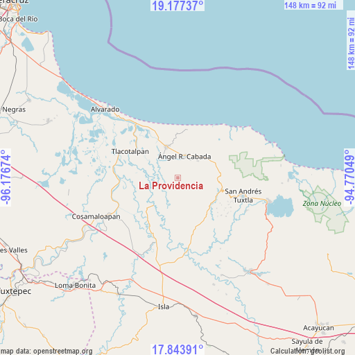
La Providencia GPS coordinates[2]
18° 30' 42.984" North, 95° 28' 24.996" West
| Map corner | latitude | longitude |
|---|---|---|
| Upper-left | 19.17737°, | -96.17674° |
| Center: | 18.51194°, | -95.47361° |
| Lower-right: | 17.84391°, | -94.77049° |
| Map W x H: | 148.3×148.3 km | = 92.1×92.1mi |
| max Lat: | 32.7° ⇑72.5% North |
| La Providencia: | 18.51194° |
| min Lat: | ⇓27.5% South 14.53588° |
| min Long | La Providencia | max Long |
| -117.105° | -95.47361° | -86.73105° |
| W 83.2%⇐ | ⇒16.8% E |
Elevation
Elevation of La Providencia is 17 m = 56 ft, and this is 1236.7 m = 4057 ft below average elevation for this country.
| Max E: |
3497 m = 11473 ft | 93% |
| Avg. | 1253.7 m = 4113 ft | |
| La Providencia | 17 m = 56 ft | |
Min E: |
-1 m = -3 ft | 7% |
See also: Mexico elevation on elevation.city.
Geographical zone
La Providencia is located in North Torrid zone (between Equator and Tropic of Cancer). Distance of this Northern Tropic circle is 547.6 km =340.3 mi to North.| Distance of | km | miles | from La Providencia |
|---|---|---|---|
| North Pole | 7948.7 | 4939.1 | to North |
| Arctic Circle | 5342.8 | 3319.9 | to North |
| Tropic Cancer | 547.6 | 340.3 | to North |
| Equator | 2058.3 | 1279 | to South |


Nearby cities:
15 places around La Providencia: (largest is in red/bold)
• Arroyo Largo
12.6 km =7.8 mi,  150°
150°
• Arroyo San Isidro
6.9 km =4.3 mi,  113°
113°
• Brazo de la Palma (El Rincón Caliente)
14.8 km =9.2 mi,  33°
33°
• Chonegal
11 km =6.8 mi,  50°
50°
• El Escobillal
9.1 km =5.7 mi, 33°
• Lerdo de Tejada
13.9 km =8.6 mi,  339°
339°
• Los Lirios
9.1 km =5.7 mi,  97°
97°
• Saltabarranca
10.8 km =6.7 mi,  324°
324°
• San Juan de los Reyes (Luis Valenzuela)
2.7 km =1.7 mi,  76°
76°
• Santa Teresa
11.9 km =7.4 mi,  350°
350°
• Tlapacoyan
9.9 km =6.2 mi,  128°
128°
• Tres Zapotes
6.2 km =3.9 mi,  141°
141°
• Tula
13.2 km =8.2 mi, 50°
• Zamora
7.8 km =4.8 mi, 352°
• Ángel R. Cabada
9.8 km =6.1 mi,  17°
17°
Sources, notices
• [Note1] Compared only with cities in Mexico existing in our database
• [Src1] Map data: © OpenStreetMap contributors (CC-BY-SA)
• [Src2] Other city data from geonames.org with taken over terms of usage.
• [Src3] Geographical zone / Annual Mean Temperature by Robert A. Rohde @ Wikipedia
