Laguna Seca geodata
Laguna Seca (State of Mexico) is a populated place; located in Mexico in America/Mexico_City (GMT-6) time zone. With population of 502 people, there are 16762 cities with bigger population in this country. Compared to other cities in Mexico, 52.4% of cities are located further ↓South; 60.6% of cities are located further →East and 97.6% of cities have lower elevation than Laguna Seca. Note1


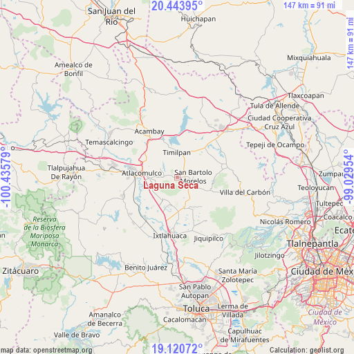
Laguna Seca GPS coordinates[2]
19° 47' 1.356" North, 99° 43' 57.576" West
| Map corner | latitude | longitude |
|---|---|---|
| Upper-left | 20.44395°, | -100.43579° |
| Center: | 19.78371°, | -99.73266° |
| Lower-right: | 19.12072°, | -99.02954° |
| Map W x H: | 147.1×147.1 km | = 91.4×91.4mi |
| max Lat: | 32.7° ⇑47.6% North |
| Laguna Seca: | 19.78371° |
| min Lat: | ⇓52.4% South 14.53588° |
| min Long | Laguna Seca | max Long |
| -117.105° | -99.73266° | -86.73105° |
| W 39.4%⇐ | ⇒60.6% E |
Elevation
Elevation of Laguna Seca is 2720 m = 8924 ft, and this is 1466.3 m = 4811 ft above average elevation for this country.
| Max E: |
3497 m = 11473 ft | 2.4% |
| Laguna Seca | 2720 m 8924 ft | |
| Avg. | 1253.7 m = 4113 ft | |
Min E: |
-1 m = -3 ft | 97.6% |
See also: Mexico elevation on elevation.city.
Geographical zone
Laguna Seca is located in North Torrid zone (between Equator and Tropic of Cancer). Distance of this Northern Tropic circle is 406.2 km =252.4 mi to North.| Distance of | km | miles | from Laguna Seca |
|---|---|---|---|
| North Pole | 7807.3 | 4851.2 | to North |
| Arctic Circle | 5201.4 | 3232 | to North |
| Tropic Cancer | 406.2 | 252.4 | to North |
| Equator | 2199.7 | 1366.8 | to South |


Nearby cities:
15 places around Laguna Seca: (largest is in red/bold)
• Barrio Cuarto (La Loma)
6.1 km =3.8 mi,  106°
106°
• Barrio Primero (La Calavera)
5.1 km =3.2 mi,  86°
86°
• Barrio Tercero
7.5 km =4.7 mi, 89°
• Barrio de la Luz
8 km =5 mi,  166°
166°
• Barrio el Lindero
6.5 km =4 mi,  158°
158°
• Colonia Francisco I. Madero
2.3 km =1.4 mi,  344°
344°
• Huemetla
7.6 km =4.7 mi,  182°
182°
• San Antonio Yondejé (Yondejé)
5.6 km =3.5 mi,  347°
347°
• San Bartolo Morelos
6.7 km =4.2 mi, 87°
• San Felipe Pueblo Nuevo
3.2 km =2 mi,  236°
236°
• San Marcos Tlazalpan
3 km =1.9 mi,  32°
32°
• San Pedro del Rosal
8.4 km =5.2 mi,  265°
265°
• Santiago Acutzilapan
3.5 km =2.2 mi, 274°
• Santiago Yeché
8.6 km =5.3 mi, 165°
• Xhinte de Lagos
5.2 km =3.2 mi,  41°
41°
Sources, notices
• [Note1] Compared only with cities in Mexico existing in our database
• [Src1] Map data: © OpenStreetMap contributors (CC-BY-SA)
• [Src2] Other city data from geonames.org with taken over terms of usage.
• [Src3] Geographical zone / Annual Mean Temperature by Robert A. Rohde @ Wikipedia
