Guigubá geodata
Guigubá (Oaxaca) is a populated place; located in Mexico in America/Mexico_City (GMT-6) time zone. With population of 809 people, there are 10801 cities with bigger population in this country. Compared to other cities in Mexico, 91.8% of cities are located further ↑North; 84.3% of cities are located further ←West and 74% of cities have higher elevation than Guigubá. Note1


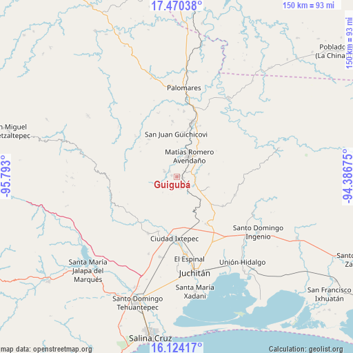
Guigubá GPS coordinates[2]
16° 47' 54.492" North, 95° 5' 23.532" West
| Map corner | latitude | longitude |
|---|---|---|
| Upper-left | 17.47038°, | -95.793° |
| Center: | 16.79847°, | -95.08987° |
| Lower-right: | 16.12417°, | -94.38675° |
| Map W x H: | 149.7×149.7 km | = 93×93mi |
| max Lat: | 32.7° ⇑91.8% North |
| Guigubá: | 16.79847° |
| min Lat: | ⇓8.2% South 14.53588° |
| min Long | Guigubá | max Long |
| -117.105° | -95.08987° | -86.73105° |
| W 84.3%⇐ | ⇒15.7% E |
Elevation
Elevation of Guigubá is 255 m = 837 ft, and this is 998.7 m = 3277 ft below average elevation for this country.
| Max E: |
3497 m = 11473 ft | 74% |
| Avg. | 1253.7 m = 4113 ft | |
| Guigubá | 255 m = 837 ft | |
Min E: |
-1 m = -3 ft | 26% |
See also: Mexico elevation on elevation.city.
Geographical zone
Guigubá is located in North Torrid zone (between Equator and Tropic of Cancer). Distance of this Northern Tropic circle is 738.1 km =458.6 mi to North.| Distance of | km | miles | from Guigubá |
|---|---|---|---|
| North Pole | 8139.2 | 5057.5 | to North |
| Arctic Circle | 5533.4 | 3438.3 | to North |
| Tropic Cancer | 738.1 | 458.6 | to North |
| Equator | 1867.8 | 1160.6 | to South |


Nearby cities:
15 places around Guigubá: (largest is in red/bold)
• Buenavista
3.8 km =2.4 mi,  48°
48°
• Chivela
13.7 km =8.5 mi,  133°
133°
• Chivixhuyo
13.5 km =8.4 mi,  83°
83°
• Colonia Progreso
1.1 km =0.7 mi,  74°
74°
• Colonia Rincón Viejo
10.8 km =6.7 mi,  24°
24°
• El Bajío
11.6 km =7.2 mi,  29°
29°
• El Barrio de la Soledad
2.5 km =1.6 mi,  283°
283°
• El Chocolate
14.8 km =9.2 mi,  0°
0°
• Fraccionamiento Loma Azul
0.8 km =0.5 mi,  239°
239°
• Hidalgo Norte
9.9 km =6.2 mi, 23°
• Llano Suchiapa
8.4 km =5.2 mi, 26°
• Matías Romero
10.4 km =6.5 mi, 30°
• Niza Conejo
2.8 km =1.7 mi,  63°
63°
• Santa María Petapa
4 km =2.5 mi,  308°
308°
• Santo Domingo Petapa
5.9 km =3.7 mi,  292°
292°
Sources, notices
• [Note1] Compared only with cities in Mexico existing in our database
• [Src1] Map data: © OpenStreetMap contributors (CC-BY-SA)
• [Src2] Other city data from geonames.org with taken over terms of usage.
• [Src3] Geographical zone / Annual Mean Temperature by Robert A. Rohde @ Wikipedia
