Providencia de Cacalote geodata
Providencia de Cacalote (Guanajuato) is a populated place; located in Mexico in America/Mexico_City (GMT-6) time zone. With population of 605 people, there are 14228 cities with bigger population in this country. Compared to other cities in Mexico, 64.5% of cities are located further ↓South; 71.8% of cities are located further →East and 62.5% of cities have lower elevation than Providencia de Cacalote. Note1
Current local time in Providencia de Cacalote:
01:00 AM, WednesdayDifference from your time zone: hours


Providencia de Cacalote GPS coordinates[2]
20° 20' 42.252" North, 100° 47' 24.972" West
| Map corner | latitude | longitude |
|---|---|---|
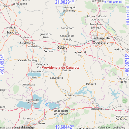
| Upper-left | 21.00291°, | -101.4934° |
| Center: | 20.34507°, | -100.79027° |
| Lower-right: | 19.68442°, | -100.08715° |
| Map W x H: | 146.6×146.6 km | = 91.1×91.1mi |
| max Lat: | 32.7° ⇑35.5% North |
| Providencia de Cacalote: | 20.34507° |
| min Lat: | ⇓64.5% South 14.53588° |
| min Long | Providencia de | max Long |
| -117.105° | -100.79027° | -86.73105° |
| W 28.2%⇐ | ⇒71.8% E |
Elevation
Elevation of Providencia de Cacalote is 1769 m = 5804 ft, and this is 515.3 m = 1691 ft above average elevation for this country.
| Max E: |
3497 m = 11473 ft | 37.5% |
| Providencia de Cacalote | 1769 m 5804 ft | |
| Avg. | 1253.7 m = 4113 ft | |
Min E: |
-1 m = -3 ft | 62.5% |
See also: Mexico elevation on elevation.city.
Geographical zone
Providencia de Cacalote is located in North Torrid zone (between Equator and Tropic of Cancer). Distance of this Northern Tropic circle is 343.8 km =213.6 mi to North.| Distance of | km | miles | from Providencia de Cacalote |
|---|---|---|---|
| North Pole | 7744.9 | 4812.5 | to North |
| Arctic Circle | 5139 | 3193.2 | to North |
| Tropic Cancer | 343.8 | 213.6 | to North |
| Equator | 2262.2 | 1405.7 | to South |


Nearby cities:
15 places around Providencia de Cacalote: (largest is in red/bold)
• Arreguín de Arriba
9.2 km =5.7 mi,  328°
328°
• Charco Largo
8.4 km =5.2 mi,  195°
195°
• El Sauz (El Sauz de Villaseñor)
7.3 km =4.5 mi,  354°
354°
• Galerade Panales
6.2 km =3.9 mi, 204°
• La Calera
7.5 km =4.7 mi,  229°
229°
• La Estancia de San José del Carmen
9.2 km =5.7 mi, 233°
• La Gavia
10.9 km =6.8 mi,  300°
300°
• La Moncada
7 km =4.3 mi,  192°
192°
• La Noria de Gallegos
1.2 km =0.7 mi,  152°
152°
• Ojo Seco
4.7 km =2.9 mi, 351°
• Panales Jamaica (Cañones)
6.5 km =4 mi,  211°
211°
• Rincón de Tamayo
9.5 km =5.9 mi,  23°
23°
• San Juan Bautista Cacalote
0.4 km =0.2 mi,  31°
31°
• Santa María del Refugio
10.6 km =6.6 mi, 354°
• Tarimoro
7.8 km =4.8 mi, 151°
Sources, notices
• [Note1] Compared only with cities in Mexico existing in our database
• [Src1] Map data: © OpenStreetMap contributors (CC-BY-SA)
• [Src2] Other city data from geonames.org with taken over terms of usage.
• [Src3] Geographical zone / Annual Mean Temperature by Robert A. Rohde @ Wikipedia
