La Gavia geodata
La Gavia (Guanajuato) is a populated place; located in Mexico in America/Mexico_City (GMT-6) time zone. With population of 1,432 people, there are 6031 cities with bigger population in this country. Compared to other cities in Mexico, 65.5% of cities are located further ↓South; 72.5% of cities are located further →East and 88.5% of cities have lower elevation than La Gavia. Note1


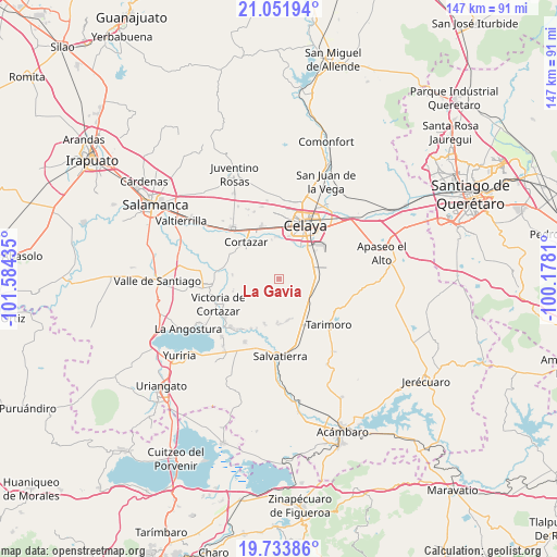
La Gavia GPS coordinates[2]
20° 23' 39.516" North, 100° 52' 52.392" West
| Map corner | latitude | longitude |
|---|---|---|
| Upper-left | 21.05194°, | -101.58435° |
| Center: | 20.39431°, | -100.88122° |
| Lower-right: | 19.73386°, | -100.1781° |
| Map W x H: | 146.6×146.6 km | = 91.1×91.1mi |
| max Lat: | 32.7° ⇑34.5% North |
| La Gavia: | 20.39431° |
| min Lat: | ⇓65.5% South 14.53588° |
| min Long | La Gavia | max Long |
| -117.105° | -100.88122° | -86.73105° |
| W 27.5%⇐ | ⇒72.5% E |
Elevation
Elevation of La Gavia is 2355 m = 7726 ft, and this is 1101.3 m = 3613 ft above average elevation for this country.
| Max E: |
3497 m = 11473 ft | 11.5% |
| La Gavia | 2355 m 7726 ft | |
| Avg. | 1253.7 m = 4113 ft | |
Min E: |
-1 m = -3 ft | 88.5% |
See also: Mexico elevation on elevation.city.
Geographical zone
La Gavia is located in North Torrid zone (between Equator and Tropic of Cancer). Distance of this Northern Tropic circle is 338.3 km =210.2 mi to North.| Distance of | km | miles | from La Gavia |
|---|---|---|---|
| North Pole | 7739.4 | 4809 | to North |
| Arctic Circle | 5133.5 | 3189.8 | to North |
| Tropic Cancer | 338.3 | 210.2 | to North |
| Equator | 2267.6 | 1409 | to South |


Nearby cities:
15 places around La Gavia: (largest is in red/bold)
• Arreguín de Arriba
5.2 km =3.2 mi,  63°
63°
• Cañada de Caracheo
7 km =4.3 mi,  252°
252°
• El Huizache
8.6 km =5.3 mi,  288°
288°
• El Puesto
10 km =6.2 mi,  33°
33°
• El Sauz (El Sauz de Villaseñor)
9 km =5.6 mi,  78°
78°
• El Zapote
6.3 km =3.9 mi,  307°
307°
• Jofre
9.7 km =6 mi, 25°
• La Calera
11 km =6.8 mi,  159°
159°
• Ojo Seco
8.9 km =5.5 mi,  95°
95°
• Providencia de Cacalote
10.9 km =6.8 mi,  120°
120°
• San Juan Bautista Cacalote
11 km =6.8 mi, 117°
• San Nicolás de Manantiales
8.7 km =5.4 mi,  271°
271°
• Santa Anita
10.9 km =6.8 mi,  39°
39°
• Santa María del Refugio
9.9 km =6.2 mi, 58°
• Valencia de Fuentes
10.4 km =6.5 mi,  301°
301°
Sources, notices
• [Note1] Compared only with cities in Mexico existing in our database
• [Src1] Map data: © OpenStreetMap contributors (CC-BY-SA)
• [Src2] Other city data from geonames.org with taken over terms of usage.
• [Src3] Geographical zone / Annual Mean Temperature by Robert A. Rohde @ Wikipedia
