Workum geodata
Workum (Friesland) is a populated place; located in Netherlands in Europe/Amsterdam (GMT+2) time zone. With population of 4,105 people, there are 577 cities with bigger population in this country. Compared to other cities in Netherlands, 84.9% of cities are located further ↓South; 59% of cities are located further →East and 83.9% of cities have higher elevation than Workum. Note1


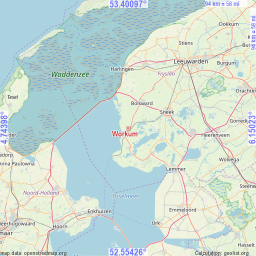
Workum GPS coordinates[2]
52° 58' 46.884" North, 5° 26' 49.56" East
| Map corner | latitude | longitude |
|---|---|---|
| Upper-left | 53.40097°, | 4.74398° |
| Center: | 52.97969°, | 5.4471° |
| Lower-right: | 52.55426°, | 6.15023° |
| Map W x H: | 94.1×94.1 km | = 58.5×58.5mi |
| max Lat: | 53.48025° ⇑15.1% North |
| Workum: | 52.97969° |
| min Lat: | ⇓84.9% South 50.76917° |
| min Long | Workum | max Long |
| 3.38611° | 5.4471° | 7.16528° |
| W 41%⇐ | ⇒59% E |
Elevation
Elevation of Workum is 1 m = 3 ft, and this is 14 m = 46 ft below average elevation for this country.
| Max E: |
203 m = 666 ft | 83.9% |
| Avg. | 15 m = 49 ft | |
| Workum | 1 m = 3 ft | |
Min E: |
-6 m = -20 ft | 16.1% |
See also: Netherlands elevation on elevation.city.
Geographical zone
Workum is located in North temperate zone (between Tropic of Cancer and the Arctic Circle). Distance of this North polar circle is 1510.4 km =938.5 mi to North.| Distance of | km | miles | from Workum |
|---|---|---|---|
| North Pole | 4116.3 | 2557.7 | to North |
| Arctic Circle | 1510.4 | 938.5 | to North |
| Tropic Cancer | 3284.9 | 2041.1 | to South |
| Equator | 5890.8 | 3660.4 | to South |


Nearby cities:
15 places around Workum: (largest is in red/bold)
• Bakhuizen
12.3 km =7.6 mi,  176°
176°
• Balk
12.7 km =7.9 mi,  135°
135°
• Blauwhuis
7.4 km =4.6 mi,  51°
51°
• Bolsward
11.1 km =6.9 mi,  30°
30°
• Heeg
11 km =6.8 mi,  96°
96°
• Hemelum
11 km =6.8 mi, 176°
• Hindeloopen
5.2 km =3.2 mi,  216°
216°
• IJlst
12.3 km =7.6 mi,  73°
73°
• Koudum
7.1 km =4.4 mi, 179°
• Makkum
8.8 km =5.5 mi,  340°
340°
• Nijland
11.6 km =7.2 mi, 47°
• Oudega
7 km =4.3 mi,  78°
78°
• Stavoren
12.1 km =7.5 mi,  209°
209°
• Warns
11.2 km =7 mi,  195°
195°
• Woudsend
12.8 km =8 mi,  108°
108°
Sources, notices
• [Note1] Compared only with cities in Netherlands existing in our database
• [Src1] Map data: © OpenStreetMap contributors (CC-BY-SA)
• [Src2] Other city data from geonames.org with taken over terms of usage.
• [Src3] Geographical zone / Annual Mean Temperature by Robert A. Rohde @ Wikipedia
