Wolfsbos geodata
Wolfsbos (Drenthe) is a section of populated place; located in Netherlands in Europe/Amsterdam (GMT+2) time zone. With population of 4,215 people, there are 568 cities with bigger population in this country. Compared to other cities in Netherlands, 77.2% of cities are located further ↓South; 88.7% of cities are located further ←West and 62% of cities have lower elevation than Wolfsbos. Note1


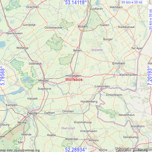
Wolfsbos GPS coordinates[2]
52° 43' 2.424" North, 6° 29' 55.716" East
| Map corner | latitude | longitude |
|---|---|---|
| Upper-left | 53.14118°, | 5.79568° |
| Center: | 52.71734°, | 6.49881° |
| Lower-right: | 52.28934°, | 7.20193° |
| Map W x H: | 94.7×94.7 km | = 58.8×58.8mi |
| max Lat: | 53.48025° ⇑22.8% North |
| Wolfsbos: | 52.71734° |
| min Lat: | ⇓77.2% South 50.76917° |
| min Long | Wolfsbos | max Long |
| 3.38611° | 6.49881° | 7.16528° |
| W 88.7%⇐ | ⇒11.3% E |
Elevation
Elevation of Wolfsbos is 11 m = 36 ft, and this is 4 m = 13 ft below average elevation for this country.
| Max E: |
203 m = 666 ft | 38% |
| Avg. | 15 m = 49 ft | |
| Wolfsbos | 11 m = 36 ft | |
Min E: |
-6 m = -20 ft | 62% |
See also: Netherlands elevation on elevation.city.
Geographical zone
Wolfsbos is located in North temperate zone (between Tropic of Cancer and the Arctic Circle). Distance of this North polar circle is 1539.6 km =956.7 mi to North.| Distance of | km | miles | from Wolfsbos |
|---|---|---|---|
| North Pole | 4145.4 | 2575.8 | to North |
| Arctic Circle | 1539.6 | 956.7 | to North |
| Tropic Cancer | 3255.7 | 2023 | to South |
| Equator | 5861.6 | 3642.2 | to South |


Nearby cities:
15 places around Wolfsbos: (largest is in red/bold)
• Alteveer
4.8 km =3 mi,  190°
190°
• Dalerpeel
11.6 km =7.2 mi,  110°
110°
• De Wijk
14.9 km =9.3 mi,  250°
250°
• Gees
13.2 km =8.2 mi,  75°
75°
• Geesbrug
9.1 km =5.7 mi, 83°
• Hoogeveen
1.6 km =1 mi,  290°
290°
• IJhorst
15.4 km =9.6 mi, 245°
• Kerkenveld
5.4 km =3.4 mi,  179°
179°
• Koekange
12.4 km =7.7 mi,  260°
260°
• Krakeel
1.1 km =0.7 mi,  51°
51°
• Nieuw Moscou
5.6 km =3.5 mi,  152°
152°
• Nieuw-Balinge
9.1 km =5.7 mi, 52°
• Ruinen
11 km =6.8 mi,  297°
297°
• Steenwijksmoer
14.5 km =9 mi, 111°
• Wijster
11.1 km =6.9 mi,  6°
6°
Sources, notices
• [Note1] Compared only with cities in Netherlands existing in our database
• [Src1] Map data: © OpenStreetMap contributors (CC-BY-SA)
• [Src2] Other city data from geonames.org with taken over terms of usage.
• [Src3] Geographical zone / Annual Mean Temperature by Robert A. Rohde @ Wikipedia
