Westerzicht geodata
Westerzicht (Zeeland) is a section of populated place; located in Netherlands in Europe/Amsterdam (GMT+2) time zone. With population of 1,595 people, there are 1084 cities with bigger population in this country. Compared to other cities in Netherlands, 83.1% of cities are located further ↑North; 99% of cities are located further →East and 83.9% of cities have higher elevation than Westerzicht. Note1


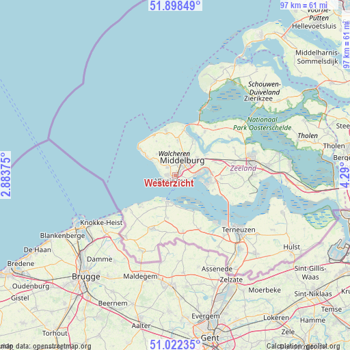
Westerzicht GPS coordinates[2]
51° 27' 45.072" North, 3° 35' 12.732" East
| Map corner | latitude | longitude |
|---|---|---|
| Upper-left | 51.89849°, | 2.88375° |
| Center: | 51.46252°, | 3.58687° |
| Lower-right: | 51.02235°, | 4.29° |
| Map W x H: | 97.4×97.4 km | = 60.5×60.5mi |
| max Lat: | 53.48025° ⇑83.1% North |
| Westerzicht: | 51.46252° |
| min Lat: | ⇓16.9% South 50.76917° |
| min Long | Westerzicht | max Long |
| 3.38611° | 3.58687° | 7.16528° |
| W 1%⇐ | ⇒99% E |
Elevation
Elevation of Westerzicht is 1 m = 3 ft, and this is 14 m = 46 ft below average elevation for this country.
| Max E: |
203 m = 666 ft | 83.9% |
| Avg. | 15 m = 49 ft | |
| Westerzicht | 1 m = 3 ft | |
Min E: |
-6 m = -20 ft | 16.1% |
See also: Netherlands elevation on elevation.city.
Geographical zone
Westerzicht is located in North temperate zone (between Tropic of Cancer and the Arctic Circle). Distance of this North polar circle is 1679.1 km =1043.3 mi to North.| Distance of | km | miles | from Westerzicht |
|---|---|---|---|
| North Pole | 4285 | 2662.6 | to North |
| Arctic Circle | 1679.1 | 1043.3 | to North |
| Tropic Cancer | 3116.2 | 1936.3 | to South |
| Equator | 5722.1 | 3555.5 | to South |


Nearby cities:
15 places around Westerzicht: (largest is in red/bold)
• Arnemuiden
7.5 km =4.7 mi,  54°
54°
• Biggekerke
5.8 km =3.6 mi,  314°
314°
• Breskens
7.7 km =4.8 mi,  196°
196°
• Brigdamme
6.1 km =3.8 mi,  12°
12°
• Dauwendaele
4.3 km =2.7 mi,  38°
38°
• Griffioen
4.8 km =3 mi, 7°
• Klarenbeek
5.5 km =3.4 mi,  17°
17°
• Koudekerke
3.1 km =1.9 mi, 313°
• Lammerenburg
2 km =1.2 mi,  283°
283°
• Meliskerke
7.8 km =4.8 mi,  317°
317°
• Middelburg
4.6 km =2.9 mi, 24°
• Nieuw- en Sint Joosland
5.4 km =3.4 mi,  64°
64°
• Sint Laurens
7.3 km =4.5 mi, 8°
• Vlissingen
2.4 km =1.5 mi, 202°
• West-Souburg
0.4 km =0.2 mi, 61°
Sources, notices
• [Note1] Compared only with cities in Netherlands existing in our database
• [Src1] Map data: © OpenStreetMap contributors (CC-BY-SA)
• [Src2] Other city data from geonames.org with taken over terms of usage.
• [Src3] Geographical zone / Annual Mean Temperature by Robert A. Rohde @ Wikipedia
