Nieuw- en Sint Joosland geodata
Nieuw- en Sint Joosland (Zeeland) is a populated place; located in Netherlands in Europe/Amsterdam (GMT+2) time zone. With population of 1,140 people, there are 1307 cities with bigger population in this country. Compared to other cities in Netherlands, 82% of cities are located further ↑North; 98.4% of cities are located further →East and 74.9% of cities have higher elevation than Nieuw- en Sint Joosland. Note1
Current local time in Nieuw- en Sint Joosland:
06:41 AM, ThursdayDifference from your time zone: hours


Nieuw- en Sint Joosland GPS coordinates[2]
51° 28' 59.988" North, 3° 39' 24.984" East
| Map corner | latitude | longitude |
|---|---|---|
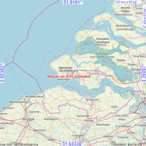
| Upper-left | 51.9191°, | 2.95382° |
| Center: | 51.48333°, | 3.65694° |
| Lower-right: | 51.04336°, | 4.36007° |
| Map W x H: | 97.4×97.4 km | = 60.5×60.5mi |
| max Lat: | 53.48025° ⇑82% North |
| Nieuw- en Sint Joosland: | 51.48333° |
| min Lat: | ⇓18% South 50.76917° |
| min Long | Nieuw- en Sint | max Long |
| 3.38611° | 3.65694° | 7.16528° |
| W 1.6%⇐ | ⇒98.4% E |
Elevation
Elevation of Nieuw- en Sint Joosland is 2 m = 7 ft, and this is 13 m = 43 ft below average elevation for this country.
| Max E: |
203 m = 666 ft | 74.9% |
| Avg. | 15 m = 49 ft | |
| Nieuw- en Sint Joosland | 2 m = 7 ft | |
Min E: |
-6 m = -20 ft | 25.1% |
See also: Netherlands elevation on elevation.city.
Geographical zone
Nieuw- en Sint Joosland is located in North temperate zone (between Tropic of Cancer and the Arctic Circle). Distance of this North polar circle is 1676.8 km =1041.9 mi to North.| Distance of | km | miles | from Nieuw- en Sint Joosland |
|---|---|---|---|
| North Pole | 4282.7 | 2661.1 | to North |
| Arctic Circle | 1676.8 | 1041.9 | to North |
| Tropic Cancer | 3118.5 | 1937.7 | to South |
| Equator | 5724.4 | 3557 | to South |


Nearby cities:
15 places around Nieuw- en Sint Joosland: (largest is in red/bold)
• Arnemuiden
2.4 km =1.5 mi,  31°
31°
• Borssele
8.6 km =5.3 mi,  141°
141°
• Brigdamme
5.1 km =3.2 mi,  315°
315°
• Dauwendaele
2.4 km =1.5 mi,  296°
296°
• Griffioen
4.9 km =3 mi, 300°
• Klarenbeek
4.3 km =2.7 mi,  312°
312°
• Koudekerke
7.1 km =4.4 mi,  268°
268°
• Lammerenburg
7.1 km =4.4 mi,  254°
254°
• Middelburg
3.5 km =2.2 mi, 301°
• Serooskerke
8.4 km =5.2 mi,  329°
329°
• Sint Laurens
6.2 km =3.9 mi, 322°
• Vlissingen
7.3 km =4.5 mi,  231°
231°
• West-Souburg
5 km =3.1 mi,  244°
244°
• Westerzicht
5.4 km =3.4 mi, 244°
• Zanddijk
6.3 km =3.9 mi,  0°
0°
Sources, notices
• [Note1] Compared only with cities in Netherlands existing in our database
• [Src1] Map data: © OpenStreetMap contributors (CC-BY-SA)
• [Src2] Other city data from geonames.org with taken over terms of usage.
• [Src3] Geographical zone / Annual Mean Temperature by Robert A. Rohde @ Wikipedia
