Dauwendaele geodata
Dauwendaele (Zeeland) is a section of populated place; located in Netherlands in Europe/Amsterdam (GMT+2) time zone. With population of 6,220 people, there are 400 cities with bigger population in this country. Compared to other cities in Netherlands, 81.3% of cities are located further ↑North; 98.5% of cities are located further →East and 83.9% of cities have higher elevation than Dauwendaele. Note1


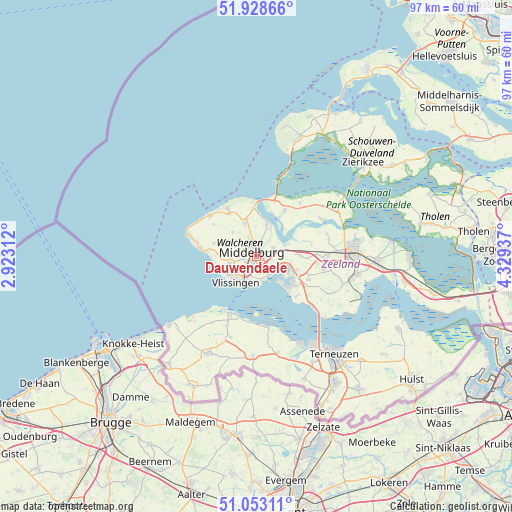
Dauwendaele GPS coordinates[2]
51° 29' 34.764" North, 3° 37' 34.464" East
| Map corner | latitude | longitude |
|---|---|---|
| Upper-left | 51.92866°, | 2.92312° |
| Center: | 51.49299°, | 3.62624° |
| Lower-right: | 51.05311°, | 4.32937° |
| Map W x H: | 97.4×97.4 km | = 60.5×60.5mi |
| max Lat: | 53.48025° ⇑81.3% North |
| Dauwendaele: | 51.49299° |
| min Lat: | ⇓18.7% South 50.76917° |
| min Long | Dauwendaele | max Long |
| 3.38611° | 3.62624° | 7.16528° |
| W 1.5%⇐ | ⇒98.5% E |
Elevation
Elevation of Dauwendaele is 1 m = 3 ft, and this is 14 m = 46 ft below average elevation for this country.
| Max E: |
203 m = 666 ft | 83.9% |
| Avg. | 15 m = 49 ft | |
| Dauwendaele | 1 m = 3 ft | |
Min E: |
-6 m = -20 ft | 16.1% |
See also: Netherlands elevation on elevation.city.
Geographical zone
Dauwendaele is located in North temperate zone (between Tropic of Cancer and the Arctic Circle). Distance of this North polar circle is 1675.7 km =1041.2 mi to North.| Distance of | km | miles | from Dauwendaele |
|---|---|---|---|
| North Pole | 4281.6 | 2660.5 | to North |
| Arctic Circle | 1675.7 | 1041.2 | to North |
| Tropic Cancer | 3119.6 | 1938.4 | to South |
| Equator | 5725.5 | 3557.7 | to South |


Nearby cities:
15 places around Dauwendaele: (largest is in red/bold)
• Arnemuiden
3.5 km =2.2 mi,  74°
74°
• Brigdamme
2.9 km =1.8 mi,  330°
330°
• Griffioen
2.5 km =1.6 mi,  303°
303°
• Grijpskerke
6.4 km =4 mi,  315°
315°
• Klarenbeek
2.1 km =1.3 mi, 330°
• Koudekerke
5.1 km =3.2 mi,  255°
255°
• Lammerenburg
5.5 km =3.4 mi,  238°
238°
• Middelburg
1.2 km =0.7 mi,  312°
312°
• Nieuw- en Sint Joosland
2.4 km =1.5 mi,  116°
116°
• Serooskerke
6.5 km =4 mi,  340°
340°
• Sint Laurens
4.2 km =2.6 mi, 337°
• Vlissingen
6.7 km =4.2 mi,  212°
212°
• West-Souburg
4 km =2.5 mi,  216°
216°
• Westerzicht
4.3 km =2.7 mi, 218°
• Zanddijk
5.6 km =3.5 mi,  23°
23°
Sources, notices
• [Note1] Compared only with cities in Netherlands existing in our database
• [Src1] Map data: © OpenStreetMap contributors (CC-BY-SA)
• [Src2] Other city data from geonames.org with taken over terms of usage.
• [Src3] Geographical zone / Annual Mean Temperature by Robert A. Rohde @ Wikipedia
