Waalwijk geodata
Waalwijk (North Brabant) is a populated place; located in Netherlands in Europe/Amsterdam (GMT+2) time zone. With population of 45,610 people, there are 69 cities with bigger population in this country. Compared to other cities in Netherlands, 69.8% of cities are located further ↑North; 71.4% of cities are located further →East and 58.8% of cities have higher elevation than Waalwijk. Note1


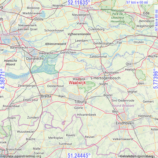
Waalwijk GPS coordinates[2]
51° 40' 57" North, 5° 4' 14.988" East
| Map corner | latitude | longitude |
|---|---|---|
| Upper-left | 52.11635°, | 4.36771° |
| Center: | 51.6825°, | 5.07083° |
| Lower-right: | 51.24445°, | 5.77396° |
| Map W x H: | 96.9×96.9 km | = 60.2×60.2mi |
| max Lat: | 53.48025° ⇑69.8% North |
| Waalwijk: | 51.6825° |
| min Lat: | ⇓30.2% South 50.76917° |
| min Long | Waalwijk | max Long |
| 3.38611° | 5.07083° | 7.16528° |
| W 28.6%⇐ | ⇒71.4% E |
Elevation
Elevation of Waalwijk is 4 m = 13 ft, and this is 11 m = 36 ft below average elevation for this country.
| Max E: |
203 m = 666 ft | 58.8% |
| Avg. | 15 m = 49 ft | |
| Waalwijk | 4 m = 13 ft | |
Min E: |
-6 m = -20 ft | 41.2% |
See also: Waalwijk elevation on elevation.city.
Geographical zone
Waalwijk is located in North temperate zone (between Tropic of Cancer and the Arctic Circle). Distance of this North polar circle is 1654.6 km =1028.1 mi to North.| Distance of | km | miles | from Waalwijk |
|---|---|---|---|
| North Pole | 4260.5 | 2647.4 | to North |
| Arctic Circle | 1654.6 | 1028.1 | to North |
| Tropic Cancer | 3140.6 | 1951.5 | to South |
| Equator | 5746.6 | 3570.8 | to South |


Nearby cities:
15 places around Waalwijk: (largest is in red/bold)
• Aalburg
9.1 km =5.7 mi,  27°
27°
• Baardwijk
2.1 km =1.3 mi,  57°
57°
• Besoijen
1.4 km =0.9 mi,  273°
273°
• De Moer
7.6 km =4.7 mi,  211°
211°
• Eethen
5.7 km =3.5 mi,  347°
347°
• Elshout
5.3 km =3.3 mi,  67°
67°
• Genderen
6 km =3.7 mi,  10°
10°
• Haarsteeg
9.4 km =5.8 mi, 69°
• Herpt
7.8 km =4.8 mi,  48°
48°
• Heusden
7.4 km =4.6 mi,  39°
39°
• Loon op Zand
6.1 km =3.8 mi,  177°
177°
• Meeuwen
6.6 km =4.1 mi,  321°
321°
• Nieuwkuijk
7.7 km =4.8 mi,  83°
83°
• Vliedberg
8.3 km =5.2 mi, 84°
• Waspik
8.7 km =5.4 mi, 273°
Sources, notices
• [Note1] Compared only with cities in Netherlands existing in our database
• [Src1] Map data: © OpenStreetMap contributors (CC-BY-SA)
• [Src2] Other city data from geonames.org with taken over terms of usage.
• [Src3] Geographical zone / Annual Mean Temperature by Robert A. Rohde @ Wikipedia
