Waspik geodata
Waspik (North Brabant) is a populated place; located in Netherlands in Europe/Amsterdam (GMT+2) time zone. With population of 5,120 people, there are 473 cities with bigger population in this country. Compared to other cities in Netherlands, 69.7% of cities are located further ↑North; 75% of cities are located further →East and 74.9% of cities have higher elevation than Waspik. Note1


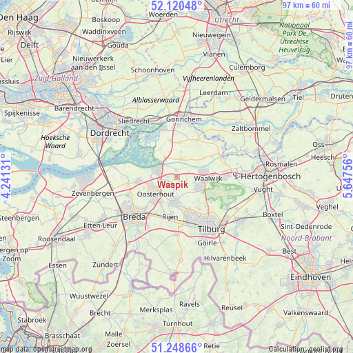
Waspik GPS coordinates[2]
51° 41' 12.012" North, 4° 56' 39.984" East
| Map corner | latitude | longitude |
|---|---|---|
| Upper-left | 52.12048°, | 4.24131° |
| Center: | 51.68667°, | 4.94444° |
| Lower-right: | 51.24866°, | 5.64756° |
| Map W x H: | 96.9×96.9 km | = 60.2×60.2mi |
| max Lat: | 53.48025° ⇑69.7% North |
| Waspik: | 51.68667° |
| min Lat: | ⇓30.3% South 50.76917° |
| min Long | Waspik | max Long |
| 3.38611° | 4.94444° | 7.16528° |
| W 25%⇐ | ⇒75% E |
Elevation
Elevation of Waspik is 2 m = 7 ft, and this is 13 m = 43 ft below average elevation for this country.
| Max E: |
203 m = 666 ft | 74.9% |
| Avg. | 15 m = 49 ft | |
| Waspik | 2 m = 7 ft | |
Min E: |
-6 m = -20 ft | 25.1% |
See also: Netherlands elevation on elevation.city.
Geographical zone
Waspik is located in North temperate zone (between Tropic of Cancer and the Arctic Circle). Distance of this North polar circle is 1654.2 km =1027.9 mi to North.| Distance of | km | miles | from Waspik |
|---|---|---|---|
| North Pole | 4260 | 2647 | to North |
| Arctic Circle | 1654.2 | 1027.9 | to North |
| Tropic Cancer | 3141.1 | 1951.8 | to South |
| Equator | 5747 | 3571 | to South |


Nearby cities:
15 places around Waspik: (largest is in red/bold)
• 's Gravenmoer
3.4 km =2.1 mi,  184°
184°
• Almkerk
9.4 km =5.8 mi,  6°
6°
• Baardwijk
10.5 km =6.5 mi,  86°
86°
• Besoijen
7.3 km =4.5 mi, 92°
• De Moer
8.4 km =5.2 mi,  145°
145°
• Den Hout
9.7 km =6 mi,  250°
250°
• Dongen
6.7 km =4.2 mi, 183°
• Eethen
9 km =5.6 mi,  55°
55°
• Geertruidenberg
6.3 km =3.9 mi,  285°
285°
• Meeuwen
6.6 km =4.1 mi,  44°
44°
• Oosteind
5.7 km =3.5 mi,  214°
214°
• Oosterhout
7.5 km =4.7 mi,  231°
231°
• Raamsdonk
2.5 km =1.6 mi,  272°
272°
• Raamsdonksveer
5 km =3.1 mi,  282°
282°
• Waalwijk
8.7 km =5.4 mi, 93°
Sources, notices
• [Note1] Compared only with cities in Netherlands existing in our database
• [Src1] Map data: © OpenStreetMap contributors (CC-BY-SA)
• [Src2] Other city data from geonames.org with taken over terms of usage.
• [Src3] Geographical zone / Annual Mean Temperature by Robert A. Rohde @ Wikipedia
