Sumar geodata
Sumar (Friesland) is a populated place; located in Netherlands in Europe/Amsterdam (GMT+2) time zone. With population of 935 people, there are 1439 cities with bigger population in this country. Compared to other cities in Netherlands, 92.3% of cities are located further ↓South; 72.9% of cities are located further ←West and 83.9% of cities have higher elevation than Sumar. Note1


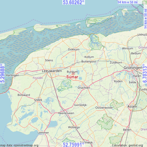
Sumar GPS coordinates[2]
53° 10' 59.988" North, 6° 0' 0" East
| Map corner | latitude | longitude |
|---|---|---|
| Upper-left | 53.60262°, | 5.29688° |
| Center: | 53.18333°, | 6° |
| Lower-right: | 52.75991°, | 6.70313° |
| Map W x H: | 93.7×93.7 km | = 58.2×58.2mi |
| max Lat: | 53.48025° ⇑7.7% North |
| Sumar: | 53.18333° |
| min Lat: | ⇓92.3% South 50.76917° |
| min Long | Sumar | max Long |
| 3.38611° | 6° | 7.16528° |
| W 72.9%⇐ | ⇒27.1% E |
Elevation
Elevation of Sumar is 1 m = 3 ft, and this is 14 m = 46 ft below average elevation for this country.
| Max E: |
203 m = 666 ft | 83.9% |
| Avg. | 15 m = 49 ft | |
| Sumar | 1 m = 3 ft | |
Min E: |
-6 m = -20 ft | 16.1% |
See also: Netherlands elevation on elevation.city.
Geographical zone
Sumar is located in North temperate zone (between Tropic of Cancer and the Arctic Circle). Distance of this North polar circle is 1487.7 km =924.4 mi to North.| Distance of | km | miles | from Sumar |
|---|---|---|---|
| North Pole | 4093.6 | 2543.6 | to North |
| Arctic Circle | 1487.7 | 924.4 | to North |
| Tropic Cancer | 3307.5 | 2055.2 | to South |
| Equator | 5913.4 | 3674.4 | to South |


Nearby cities:
15 places around Sumar: (largest is in red/bold)
• Burgum
1.2 km =0.7 mi,  326°
326°
• Eastermar
4.1 km =2.5 mi,  103°
103°
• Feanwâlden
5.9 km =3.7 mi,  352°
352°
• Garyp
2.9 km =1.8 mi,  230°
230°
• Hurdegaryp
5.1 km =3.2 mi,  310°
310°
• Jistrum
5.4 km =3.4 mi,  54°
54°
• Kootstertille
6.9 km =4.3 mi,  62°
62°
• Noardburgum
4.2 km =2.6 mi,  4°
4°
• Opeinde
6.6 km =4.1 mi,  145°
145°
• Oudega
6.5 km =4 mi,  180°
180°
• Ryptsjerk
7 km =4.3 mi, 308°
• Suwâld
4.9 km =3 mi,  263°
263°
• Twijzelerheide
7 km =4.3 mi,  25°
25°
• Tytsjerk
6.9 km =4.3 mi,  299°
299°
• Warten
7.6 km =4.7 mi,  240°
240°
Sources, notices
• [Note1] Compared only with cities in Netherlands existing in our database
• [Src1] Map data: © OpenStreetMap contributors (CC-BY-SA)
• [Src2] Other city data from geonames.org with taken over terms of usage.
• [Src3] Geographical zone / Annual Mean Temperature by Robert A. Rohde @ Wikipedia
