Rijnsaterwoude geodata
Rijnsaterwoude (South Holland) is a populated place; located in Netherlands in Europe/Amsterdam (GMT+2) time zone. With population of 1,130 people, there are 1314 cities with bigger population in this country. Compared to other cities in Netherlands, 59.8% of cities are located further ↓South; 83.9% of cities are located further →East and 98.2% of cities have higher elevation than Rijnsaterwoude. Note1


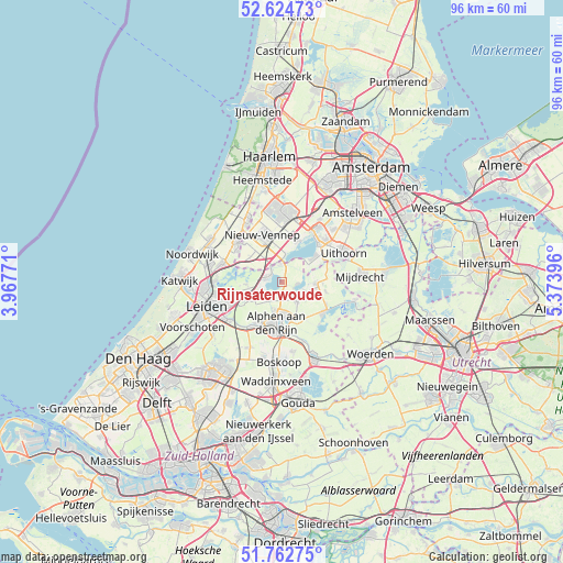
Rijnsaterwoude GPS coordinates[2]
52° 11' 44.988" North, 4° 40' 14.988" East
| Map corner | latitude | longitude |
|---|---|---|
| Upper-left | 52.62473°, | 3.96771° |
| Center: | 52.19583°, | 4.67083° |
| Lower-right: | 51.76275°, | 5.37396° |
| Map W x H: | 95.8×95.8 km | = 59.5×59.5mi |
| max Lat: | 53.48025° ⇑40.2% North |
| Rijnsaterwoude: | 52.19583° |
| min Lat: | ⇓59.8% South 50.76917° |
| min Long | Rijnsaterwoude | max Long |
| 3.38611° | 4.67083° | 7.16528° |
| W 16.1%⇐ | ⇒83.9% E |
Elevation
Elevation of Rijnsaterwoude is -2 m = -7 ft, and this is 17 m = 56 ft below average elevation for this country.
| Max E: |
203 m = 666 ft | 98.2% |
| Avg. | 15 m = 49 ft | |
| Rijnsaterwoude | -2 m = -7 ft | |
Min E: |
-6 m = -20 ft | 1.8% |
See also: Netherlands elevation on elevation.city.
Geographical zone
Rijnsaterwoude is located in North temperate zone (between Tropic of Cancer and the Arctic Circle). Distance of this North polar circle is 1597.5 km =992.6 mi to North.| Distance of | km | miles | from Rijnsaterwoude |
|---|---|---|---|
| North Pole | 4203.4 | 2611.9 | to North |
| Arctic Circle | 1597.5 | 992.6 | to North |
| Tropic Cancer | 3197.7 | 1987 | to South |
| Equator | 5803.6 | 3606.2 | to South |


Nearby cities:
15 places around Rijnsaterwoude: (largest is in red/bold)
• Abbenes
6.9 km =4.3 mi,  308°
308°
• Alphen aan den Rijn
7.5 km =4.7 mi,  188°
188°
• Hoogmade
6.7 km =4.2 mi,  243°
243°
• Korteraar
4.9 km =3 mi,  120°
120°
• Kudelstaart
6.9 km =4.3 mi,  52°
52°
• Langeraar
2.8 km =1.7 mi,  95°
95°
• Leimuiden
3.2 km =2 mi,  358°
358°
• Nieuwe Wetering
3.8 km =2.4 mi,  289°
289°
• Nieuwveen
5.9 km =3.7 mi,  89°
89°
• Oude Wetering
2.7 km =1.7 mi,  318°
318°
• Papenveer
3.9 km =2.4 mi,  108°
108°
• Rijpwetering
6 km =3.7 mi,  266°
266°
• Roelofarendsveen
2.7 km =1.7 mi, 288°
• Woubrugge
3.7 km =2.3 mi,  219°
219°
• Zevenhoven
7.6 km =4.7 mi, 102°
Sources, notices
• [Note1] Compared only with cities in Netherlands existing in our database
• [Src1] Map data: © OpenStreetMap contributors (CC-BY-SA)
• [Src2] Other city data from geonames.org with taken over terms of usage.
• [Src3] Geographical zone / Annual Mean Temperature by Robert A. Rohde @ Wikipedia
