Leimuiden geodata
Leimuiden (South Holland) is a populated place; located in Netherlands in Europe/Amsterdam (GMT+2) time zone. With population of 1,035 people, there are 1375 cities with bigger population in this country. Compared to other cities in Netherlands, 62.7% of cities are located further ↓South; 84.1% of cities are located further →East and 99.9% of cities have higher elevation than Leimuiden. Note1


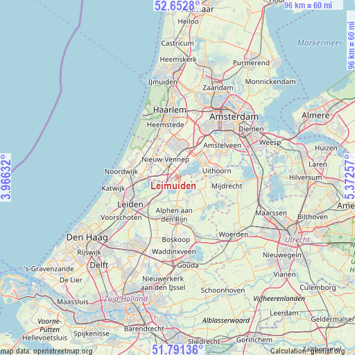
Leimuiden GPS coordinates[2]
52° 13' 27.012" North, 4° 40' 9.984" East
| Map corner | latitude | longitude |
|---|---|---|
| Upper-left | 52.6528°, | 3.96632° |
| Center: | 52.22417°, | 4.66944° |
| Lower-right: | 51.79136°, | 5.37257° |
| Map W x H: | 95.8×95.8 km | = 59.5×59.5mi |
| max Lat: | 53.48025° ⇑37.3% North |
| Leimuiden: | 52.22417° |
| min Lat: | ⇓62.7% South 50.76917° |
| min Long | Leimuiden | max Long |
| 3.38611° | 4.66944° | 7.16528° |
| W 15.9%⇐ | ⇒84.1% E |
Elevation
Elevation of Leimuiden is -4 m = -13 ft, and this is 19 m = 62 ft below average elevation for this country.
| Max E: |
203 m = 666 ft | 99.9% |
| Avg. | 15 m = 49 ft | |
| Leimuiden | -4 m = -13 ft | |
Min E: |
-6 m = -20 ft | 0.1% |
See also: Netherlands elevation on elevation.city.
Geographical zone
Leimuiden is located in North temperate zone (between Tropic of Cancer and the Arctic Circle). Distance of this North polar circle is 1594.4 km =990.7 mi to North.| Distance of | km | miles | from Leimuiden |
|---|---|---|---|
| North Pole | 4200.3 | 2609.9 | to North |
| Arctic Circle | 1594.4 | 990.7 | to North |
| Tropic Cancer | 3200.9 | 1988.9 | to South |
| Equator | 5806.8 | 3608.2 | to South |


Nearby cities:
15 places around Leimuiden: (largest is in red/bold)
• Aalsmeer
7.3 km =4.5 mi,  57°
57°
• Aalsmeerderbrug
7.8 km =4.8 mi,  44°
44°
• Abbenes
5.4 km =3.4 mi,  282°
282°
• Korteraar
7.1 km =4.4 mi,  143°
143°
• Kudelstaart
5.7 km =3.5 mi,  78°
78°
• Langeraar
4.5 km =2.8 mi, 140°
• Lisserbroek
7.5 km =4.7 mi,  298°
298°
• Nieuwe Wetering
4 km =2.5 mi,  242°
242°
• Nieuwveen
6.7 km =4.2 mi,  117°
117°
• Oude Wetering
2 km =1.2 mi, 236°
• Papenveer
5.8 km =3.6 mi, 139°
• Rijnsaterwoude
3.2 km =2 mi,  178°
178°
• Rijpwetering
6.8 km =4.2 mi, 239°
• Roelofarendsveen
3.4 km =2.1 mi,  226°
226°
• Woubrugge
6.4 km =4 mi,  200°
200°
Sources, notices
• [Note1] Compared only with cities in Netherlands existing in our database
• [Src1] Map data: © OpenStreetMap contributors (CC-BY-SA)
• [Src2] Other city data from geonames.org with taken over terms of usage.
• [Src3] Geographical zone / Annual Mean Temperature by Robert A. Rohde @ Wikipedia
