Leest geodata
Leest (North Brabant) is a populated place; located in Netherlands in Europe/Amsterdam (GMT+2) time zone. With population of 2,840 people, there are 778 cities with bigger population in this country. Compared to other cities in Netherlands, 73.3% of cities are located further ↑North; 55.1% of cities are located further →East and 62% of cities have lower elevation than Leest. Note1


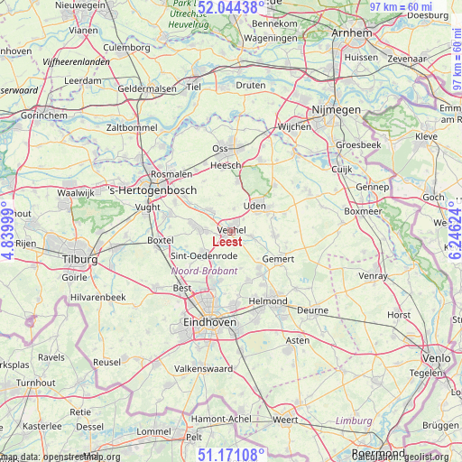
Leest GPS coordinates[2]
51° 36' 35.388" North, 5° 32' 35.232" East
| Map corner | latitude | longitude |
|---|---|---|
| Upper-left | 52.04438°, | 4.83999° |
| Center: | 51.60983°, | 5.54312° |
| Lower-right: | 51.17108°, | 6.24624° |
| Map W x H: | 97.1×97.1 km | = 60.3×60.3mi |
| max Lat: | 53.48025° ⇑73.3% North |
| Leest: | 51.60983° |
| min Lat: | ⇓26.7% South 50.76917° |
| min Long | Leest | max Long |
| 3.38611° | 5.54312° | 7.16528° |
| W 44.9%⇐ | ⇒55.1% E |
Elevation
Elevation of Leest is 11 m = 36 ft, and this is 4 m = 13 ft below average elevation for this country.
| Max E: |
203 m = 666 ft | 38% |
| Avg. | 15 m = 49 ft | |
| Leest | 11 m = 36 ft | |
Min E: |
-6 m = -20 ft | 62% |
See also: Netherlands elevation on elevation.city.
Geographical zone
Leest is located in North temperate zone (between Tropic of Cancer and the Arctic Circle). Distance of this North polar circle is 1662.7 km =1033.2 mi to North.| Distance of | km | miles | from Leest |
|---|---|---|---|
| North Pole | 4268.6 | 2652.4 | to North |
| Arctic Circle | 1662.7 | 1033.2 | to North |
| Tropic Cancer | 3132.6 | 1946.5 | to South |
| Equator | 5738.5 | 3565.7 | to South |


Nearby cities:
15 places around Leest: (largest is in red/bold)
• Eerde
3.1 km =1.9 mi,  258°
258°
• Eerschot
6.7 km =4.2 mi,  226°
226°
• Eikenheuvel
5.7 km =3.5 mi,  55°
55°
• Erp
4.5 km =2.8 mi,  103°
103°
• Heeswijk-Dinther
6.5 km =4 mi,  314°
314°
• Keldonk
3.9 km =2.4 mi,  131°
131°
• Mariaheide
3.7 km =2.3 mi,  44°
44°
• Sint-Oedenrode
7.4 km =4.6 mi, 230°
• Uden
7.7 km =4.8 mi, 42°
• Veghel
0.8 km =0.5 mi,  26°
26°
• Ven
3.4 km =2.1 mi,  8°
8°
• Vorstenbosch
4.8 km =3 mi, 5°
• Wijbosch
5.2 km =3.2 mi,  278°
278°
• Zijtaart
1.9 km =1.2 mi,  182°
182°
• Zondveld
4.1 km =2.5 mi,  166°
166°
Sources, notices
• [Note1] Compared only with cities in Netherlands existing in our database
• [Src1] Map data: © OpenStreetMap contributors (CC-BY-SA)
• [Src2] Other city data from geonames.org with taken over terms of usage.
• [Src3] Geographical zone / Annual Mean Temperature by Robert A. Rohde @ Wikipedia
