Hoogbraak geodata
Hoogbraak (North Brabant) is a populated place; located in Netherlands in Europe/Amsterdam (GMT+2) time zone. With population of 980 people, there are 1415 cities with bigger population in this country. Compared to other cities in Netherlands, 83.9% of cities are located further ↑North; 75.7% of cities are located further →East and 84.6% of cities have lower elevation than Hoogbraak. Note1


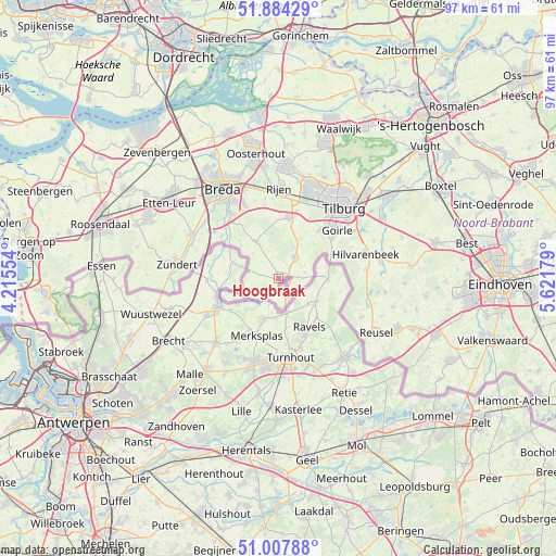
Hoogbraak GPS coordinates[2]
51° 26' 53.484" North, 4° 55' 7.212" East
| Map corner | latitude | longitude |
|---|---|---|
| Upper-left | 51.88429°, | 4.21554° |
| Center: | 51.44819°, | 4.91867° |
| Lower-right: | 51.00788°, | 5.62179° |
| Map W x H: | 97.4×97.4 km | = 60.5×60.5mi |
| max Lat: | 53.48025° ⇑83.9% North |
| Hoogbraak: | 51.44819° |
| min Lat: | ⇓16.1% South 50.76917° |
| min Long | Hoogbraak | max Long |
| 3.38611° | 4.91867° | 7.16528° |
| W 24.3%⇐ | ⇒75.7% E |
Elevation
Elevation of Hoogbraak is 26 m = 85 ft, and this is 11 m = 36 ft above average elevation for this country.
| Max E: |
203 m = 666 ft | 15.4% |
| Hoogbraak | 26 m 85 ft | |
| Avg. | 15 m = 49 ft | |
Min E: |
-6 m = -20 ft | 84.6% |
See also: Netherlands elevation on elevation.city.
Geographical zone
Hoogbraak is located in North temperate zone (between Tropic of Cancer and the Arctic Circle). Distance of this North polar circle is 1680.7 km =1044.3 mi to North.| Distance of | km | miles | from Hoogbraak |
|---|---|---|---|
| North Pole | 4286.6 | 2663.6 | to North |
| Arctic Circle | 1680.7 | 1044.3 | to North |
| Tropic Cancer | 3114.6 | 1935.3 | to South |
| Equator | 5720.5 | 3554.6 | to South |


Nearby cities:
15 places around Hoogbraak: (largest is in red/bold)
• Abcoven
14.4 km =8.9 mi,  52°
52°
• Alphen
4.6 km =2.9 mi,  36°
36°
• Baarle-Nassau
0.7 km =0.4 mi,  96°
96°
• Bavel
14.4 km =8.9 mi,  335°
335°
• Chaam
7.5 km =4.7 mi,  328°
328°
• De Blaak
14 km =8.7 mi, 38°
• De Reit
15.4 km =9.6 mi, 35°
• Esbeek
15.2 km =9.4 mi,  84°
84°
• Galder
12.3 km =7.6 mi,  307°
307°
• Gilze
10.8 km =6.7 mi,  7°
7°
• Goirle
13 km =8.1 mi, 51°
• Groenewoud
15.6 km =9.7 mi, 49°
• Korvel
15.4 km =9.6 mi, 43°
• Molenschot
14.1 km =8.8 mi,  349°
349°
• Ulvenhout
13.9 km =8.6 mi,  323°
323°
Sources, notices
• [Note1] Compared only with cities in Netherlands existing in our database
• [Src1] Map data: © OpenStreetMap contributors (CC-BY-SA)
• [Src2] Other city data from geonames.org with taken over terms of usage.
• [Src3] Geographical zone / Annual Mean Temperature by Robert A. Rohde @ Wikipedia
