Groenewoud geodata
Groenewoud (North Brabant) is a section of populated place; located in Netherlands in Europe/Amsterdam (GMT+2) time zone. With population of 7,710 people, there are 341 cities with bigger population in this country. Compared to other cities in Netherlands, 77.8% of cities are located further ↑North; 70.4% of cities are located further →East and 69% of cities have lower elevation than Groenewoud. Note1


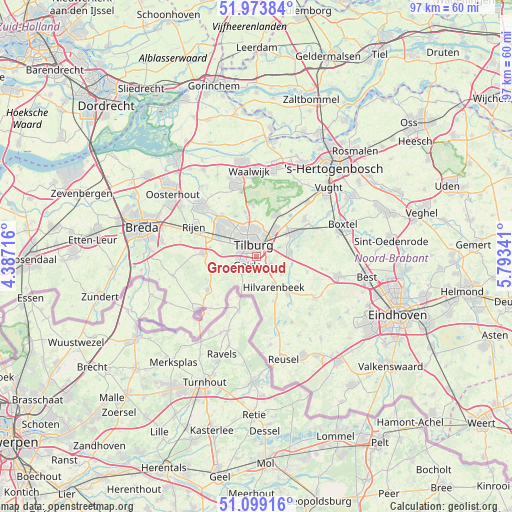
Groenewoud GPS coordinates[2]
51° 32' 18.96" North, 5° 5' 25.008" East
| Map corner | latitude | longitude |
|---|---|---|
| Upper-left | 51.97384°, | 4.38716° |
| Center: | 51.5386°, | 5.09028° |
| Lower-right: | 51.09916°, | 5.79341° |
| Map W x H: | 97.3×97.3 km | = 60.5×60.5mi |
| max Lat: | 53.48025° ⇑77.8% North |
| Groenewoud: | 51.5386° |
| min Lat: | ⇓22.2% South 50.76917° |
| min Long | Groenewoud | max Long |
| 3.38611° | 5.09028° | 7.16528° |
| W 29.6%⇐ | ⇒70.4% E |
Elevation
Elevation of Groenewoud is 14 m = 46 ft, and this is 1 m = 3 ft below average elevation for this country.
| Max E: |
203 m = 666 ft | 31% |
| Avg. | 15 m = 49 ft | |
| Groenewoud | 14 m = 46 ft | |
Min E: |
-6 m = -20 ft | 69% |
See also: Netherlands elevation on elevation.city.
Geographical zone
Groenewoud is located in North temperate zone (between Tropic of Cancer and the Arctic Circle). Distance of this North polar circle is 1670.6 km =1038.1 mi to North.| Distance of | km | miles | from Groenewoud |
|---|---|---|---|
| North Pole | 4276.5 | 2657.3 | to North |
| Arctic Circle | 1670.6 | 1038.1 | to North |
| Tropic Cancer | 3124.6 | 1941.5 | to South |
| Equator | 5730.6 | 3560.8 | to South |


Nearby cities:
15 places around Groenewoud: (largest is in red/bold)
• Abcoven
1.3 km =0.8 mi,  201°
201°
• Besterd
2.8 km =1.7 mi,  354°
354°
• Biest-Houtakker
5.9 km =3.7 mi,  127°
127°
• Broekhoven
1.1 km =0.7 mi,  5°
5°
• De Blaak
3.3 km =2.1 mi,  285°
285°
• De Reit
3.7 km =2.3 mi,  310°
310°
• Enschot
5.6 km =3.5 mi,  37°
37°
• Goirle
2.6 km =1.6 mi,  219°
219°
• Groeseind
4.1 km =2.5 mi,  356°
356°
• Hilvarenbeek
6.7 km =4.2 mi,  150°
150°
• Korvel
1.8 km =1.1 mi, 312°
• Loven
3 km =1.9 mi, 9°
• Oisterwijk
8.2 km =5.1 mi,  56°
56°
• Quirijnstok
5.1 km =3.2 mi, 6°
• Tilburg
1.9 km =1.2 mi,  2°
2°
Sources, notices
• [Note1] Compared only with cities in Netherlands existing in our database
• [Src1] Map data: © OpenStreetMap contributors (CC-BY-SA)
• [Src2] Other city data from geonames.org with taken over terms of usage.
• [Src3] Geographical zone / Annual Mean Temperature by Robert A. Rohde @ Wikipedia
