Hilvarenbeek geodata
Hilvarenbeek (North Brabant) is a populated place; located in Netherlands in Europe/Amsterdam (GMT+2) time zone. With population of 7,855 people, there are 336 cities with bigger population in this country. Compared to other cities in Netherlands, 81.9% of cities are located further ↑North; 68.6% of cities are located further →East and 74.9% of cities have lower elevation than Hilvarenbeek. Note1


Hilvarenbeek GPS coordinates[2]
51° 29' 8.988" North, 5° 8' 15" East
| Map corner | latitude | longitude |
|---|---|---|
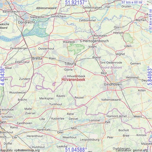
| Upper-left | 51.92157°, | 4.43438° |
| Center: | 51.48583°, | 5.1375° |
| Lower-right: | 51.04588°, | 5.84063° |
| Map W x H: | 97.4×97.4 km | = 60.5×60.5mi |
| max Lat: | 53.48025° ⇑81.9% North |
| Hilvarenbeek: | 51.48583° |
| min Lat: | ⇓18.1% South 50.76917° |
| min Long | Hilvarenbeek | max Long |
| 3.38611° | 5.1375° | 7.16528° |
| W 31.4%⇐ | ⇒68.6% E |
Elevation
Elevation of Hilvarenbeek is 18 m = 59 ft, and this is 3 m = 10 ft above average elevation for this country.
| Max E: |
203 m = 666 ft | 25.1% |
| Hilvarenbeek | 18 m 59 ft | |
| Avg. | 15 m = 49 ft | |
Min E: |
-6 m = -20 ft | 74.9% |
See also: Netherlands elevation on elevation.city.
Geographical zone
Hilvarenbeek is located in North temperate zone (between Tropic of Cancer and the Arctic Circle). Distance of this North polar circle is 1676.5 km =1041.7 mi to North.| Distance of | km | miles | from Hilvarenbeek |
|---|---|---|---|
| North Pole | 4282.4 | 2661 | to North |
| Arctic Circle | 1676.5 | 1041.7 | to North |
| Tropic Cancer | 3118.8 | 1937.9 | to South |
| Equator | 5724.7 | 3557.2 | to South |


Nearby cities:
15 places around Hilvarenbeek: (largest is in red/bold)
• Abcoven
6 km =3.7 mi,  321°
321°
• Besterd
9.4 km =5.8 mi,  337°
337°
• Biest-Houtakker
2.7 km =1.7 mi,  31°
31°
• Broekhoven
7.6 km =4.7 mi, 335°
• De Blaak
9.3 km =5.8 mi, 316°
• Diessen
2.8 km =1.7 mi,  113°
113°
• Esbeek
2.7 km =1.7 mi,  180°
180°
• Goirle
6.3 km =3.9 mi,  308°
308°
• Groenewoud
6.7 km =4.2 mi,  330°
330°
• Korvel
8.5 km =5.3 mi, 326°
• Lage Mierde
8.9 km =5.5 mi, 175°
• Loven
9.2 km =5.7 mi, 342°
• Middelbeers
8.1 km =5 mi, 105°
• Oostelbeers
9.2 km =5.7 mi,  99°
99°
• Tilburg
8.4 km =5.2 mi, 337°
Sources, notices
• [Note1] Compared only with cities in Netherlands existing in our database
• [Src1] Map data: © OpenStreetMap contributors (CC-BY-SA)
• [Src2] Other city data from geonames.org with taken over terms of usage.
• [Src3] Geographical zone / Annual Mean Temperature by Robert A. Rohde @ Wikipedia
