Eeneind geodata
Eeneind (North Brabant) is a populated place; located in Netherlands in Europe/Amsterdam (GMT+2) time zone. With population of 725 people, there are 1594 cities with bigger population in this country. Compared to other cities in Netherlands, 83.7% of cities are located further ↑North; 54.9% of cities are located further →East and 74.9% of cities have lower elevation than Eeneind. Note1


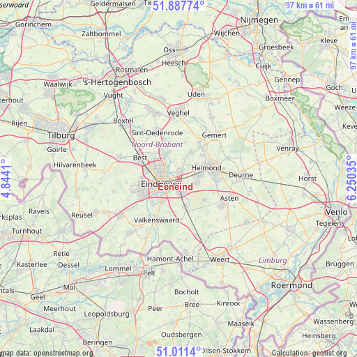
Eeneind GPS coordinates[2]
51° 27' 6.012" North, 5° 32' 49.992" East
| Map corner | latitude | longitude |
|---|---|---|
| Upper-left | 51.88774°, | 4.8441° |
| Center: | 51.45167°, | 5.54722° |
| Lower-right: | 51.0114°, | 6.25035° |
| Map W x H: | 97.4×97.4 km | = 60.5×60.5mi |
| max Lat: | 53.48025° ⇑83.7% North |
| Eeneind: | 51.45167° |
| min Lat: | ⇓16.3% South 50.76917° |
| min Long | Eeneind | max Long |
| 3.38611° | 5.54722° | 7.16528° |
| W 45.1%⇐ | ⇒54.9% E |
Elevation
Elevation of Eeneind is 18 m = 59 ft, and this is 3 m = 10 ft above average elevation for this country.
| Max E: |
203 m = 666 ft | 25.1% |
| Eeneind | 18 m 59 ft | |
| Avg. | 15 m = 49 ft | |
Min E: |
-6 m = -20 ft | 74.9% |
See also: Netherlands elevation on elevation.city.
Geographical zone
Eeneind is located in North temperate zone (between Tropic of Cancer and the Arctic Circle). Distance of this North polar circle is 1680.3 km =1044.1 mi to North.| Distance of | km | miles | from Eeneind |
|---|---|---|---|
| North Pole | 4286.2 | 2663.3 | to North |
| Arctic Circle | 1680.3 | 1044.1 | to North |
| Tropic Cancer | 3115 | 1935.6 | to South |
| Equator | 5720.9 | 3554.8 | to South |


Nearby cities:
15 places around Eeneind: (largest is in red/bold)
• 't Hofke
2 km =1.2 mi,  262°
262°
• Akert
4.3 km =2.7 mi,  168°
168°
• Coevering
4.3 km =2.7 mi,  153°
153°
• De Doornakkers
3 km =1.9 mi,  241°
241°
• Eckart
4.4 km =2.7 mi,  303°
303°
• Geldrop
3.4 km =2.1 mi, 165°
• Gerwen
4.4 km =2.7 mi,  13°
13°
• Lakerlopen
3.5 km =2.2 mi, 244°
• Muschberg en Geestenberg
1.9 km =1.2 mi, 242°
• Nuenen
2.1 km =1.3 mi, 10°
• Stepekolk
4.5 km =2.8 mi,  85°
85°
• Tivoli
4.4 km =2.7 mi,  218°
218°
• Tongelre
1.9 km =1.2 mi, 260°
• Villapark
3.9 km =2.4 mi,  252°
252°
• Zesgehuchten
3.9 km =2.4 mi,  177°
177°
Sources, notices
• [Note1] Compared only with cities in Netherlands existing in our database
• [Src1] Map data: © OpenStreetMap contributors (CC-BY-SA)
• [Src2] Other city data from geonames.org with taken over terms of usage.
• [Src3] Geographical zone / Annual Mean Temperature by Robert A. Rohde @ Wikipedia
