Villapark geodata
Villapark (North Brabant) is a section of populated place; located in Netherlands in Europe/Amsterdam (GMT+2) time zone. With population of 2,050 people, there are 948 cities with bigger population in this country. Compared to other cities in Netherlands, 84.3% of cities are located further ↑North; 57% of cities are located further →East and 80.4% of cities have lower elevation than Villapark. Note1


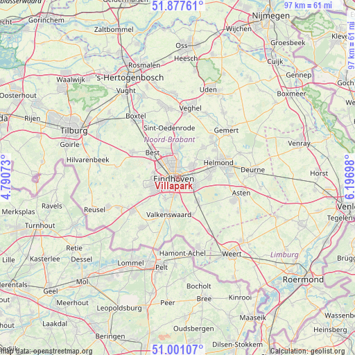
Villapark GPS coordinates[2]
51° 26' 29.184" North, 5° 29' 37.86" East
| Map corner | latitude | longitude |
|---|---|---|
| Upper-left | 51.87761°, | 4.79073° |
| Center: | 51.44144°, | 5.49385° |
| Lower-right: | 51.00107°, | 6.19698° |
| Map W x H: | 97.5×97.5 km | = 60.6×60.6mi |
| max Lat: | 53.48025° ⇑84.3% North |
| Villapark: | 51.44144° |
| min Lat: | ⇓15.7% South 50.76917° |
| min Long | Villapark | max Long |
| 3.38611° | 5.49385° | 7.16528° |
| W 43%⇐ | ⇒57% E |
Elevation
Elevation of Villapark is 21 m = 69 ft, and this is 6 m = 20 ft above average elevation for this country.
| Max E: |
203 m = 666 ft | 19.6% |
| Villapark | 21 m 69 ft | |
| Avg. | 15 m = 49 ft | |
Min E: |
-6 m = -20 ft | 80.4% |
See also: Netherlands elevation on elevation.city.
Geographical zone
Villapark is located in North temperate zone (between Tropic of Cancer and the Arctic Circle). Distance of this North polar circle is 1681.4 km =1044.8 mi to North.| Distance of | km | miles | from Villapark |
|---|---|---|---|
| North Pole | 4287.3 | 2664 | to North |
| Arctic Circle | 1681.4 | 1044.8 | to North |
| Tropic Cancer | 3113.8 | 1934.8 | to South |
| Equator | 5719.8 | 3554.1 | to South |


Nearby cities:
15 places around Villapark: (largest is in red/bold)
• 't Hofke
2 km =1.2 mi,  63°
63°
• Blaarthem
3.1 km =1.9 mi,  233°
233°
• De Doornakkers
1.1 km =0.7 mi,  107°
107°
• Eckart
3.5 km =2.2 mi,  0°
0°
• Eeneind
3.9 km =2.4 mi,  72°
72°
• Eindhoven
1.1 km =0.7 mi,  266°
266°
• Jagershoef
4 km =2.5 mi,  332°
332°
• Lakerlopen
0.6 km =0.4 mi,  128°
128°
• Lievendaal
4.1 km =2.5 mi, 271°
• Muschberg en Geestenberg
2.1 km =1.3 mi,  82°
82°
• Tivoli
2.5 km =1.6 mi,  156°
156°
• Tongelre
2 km =1.2 mi, 65°
• Vaartbroek
4.2 km =2.6 mi, 3°
• Vlokhoven
2.9 km =1.8 mi,  345°
345°
• Zesgehuchten
4.8 km =3 mi, 125°
Sources, notices
• [Note1] Compared only with cities in Netherlands existing in our database
• [Src1] Map data: © OpenStreetMap contributors (CC-BY-SA)
• [Src2] Other city data from geonames.org with taken over terms of usage.
• [Src3] Geographical zone / Annual Mean Temperature by Robert A. Rohde @ Wikipedia
