Coevering geodata
Coevering (North Brabant) is a section of populated place; located in Netherlands in Europe/Amsterdam (GMT+2) time zone. With population of 5,290 people, there are 457 cities with bigger population in this country. Compared to other cities in Netherlands, 85.5% of cities are located further ↑North; 53.5% of cities are located further →East and 81.4% of cities have lower elevation than Coevering. Note1


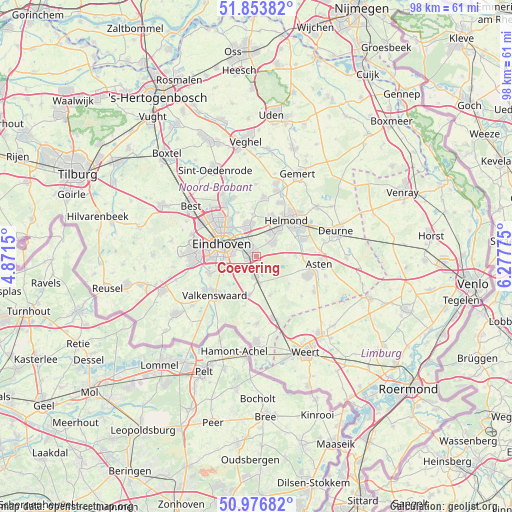
Coevering GPS coordinates[2]
51° 25' 2.712" North, 5° 34' 28.668" East
| Map corner | latitude | longitude |
|---|---|---|
| Upper-left | 51.85382°, | 4.8715° |
| Center: | 51.41742°, | 5.57463° |
| Lower-right: | 50.97682°, | 6.27775° |
| Map W x H: | 97.5×97.5 km | = 60.6×60.6mi |
| max Lat: | 53.48025° ⇑85.5% North |
| Coevering: | 51.41742° |
| min Lat: | ⇓14.5% South 50.76917° |
| min Long | Coevering | max Long |
| 3.38611° | 5.57463° | 7.16528° |
| W 46.5%⇐ | ⇒53.5% E |
Elevation
Elevation of Coevering is 22 m = 72 ft, and this is 7 m = 23 ft above average elevation for this country.
| Max E: |
203 m = 666 ft | 18.6% |
| Coevering | 22 m 72 ft | |
| Avg. | 15 m = 49 ft | |
Min E: |
-6 m = -20 ft | 81.4% |
See also: Netherlands elevation on elevation.city.
Geographical zone
Coevering is located in North temperate zone (between Tropic of Cancer and the Arctic Circle). Distance of this North polar circle is 1684.1 km =1046.5 mi to North.| Distance of | km | miles | from Coevering |
|---|---|---|---|
| North Pole | 4290 | 2665.7 | to North |
| Arctic Circle | 1684.1 | 1046.5 | to North |
| Tropic Cancer | 3111.2 | 1933.2 | to South |
| Equator | 5717.1 | 3552.4 | to South |


Nearby cities:
15 places around Coevering: (largest is in red/bold)
• 't Hofke
5.2 km =3.2 mi,  312°
312°
• Akert
1.1 km =0.7 mi,  250°
250°
• Brand
5.7 km =3.5 mi,  37°
37°
• De Doornakkers
5.1 km =3.2 mi,  297°
297°
• Eeneind
4.3 km =2.7 mi,  333°
333°
• Geldrop
1.1 km =0.7 mi,  294°
294°
• Genoenhuis
2.6 km =1.6 mi, 249°
• Heeze
3.9 km =2.4 mi,  183°
183°
• Lakerlopen
5.6 km =3.5 mi, 294°
• Mierlo
4 km =2.5 mi,  51°
51°
• Muschberg en Geestenberg
4.6 km =2.9 mi, 309°
• Stepekolk
4.9 km =3 mi,  32°
32°
• Tivoli
4.6 km =2.9 mi,  274°
274°
• Tongelre
5.2 km =3.2 mi, 312°
• Zesgehuchten
1.7 km =1.1 mi, 267°
Sources, notices
• [Note1] Compared only with cities in Netherlands existing in our database
• [Src1] Map data: © OpenStreetMap contributors (CC-BY-SA)
• [Src2] Other city data from geonames.org with taken over terms of usage.
• [Src3] Geographical zone / Annual Mean Temperature by Robert A. Rohde @ Wikipedia
