Dronryp geodata
Dronryp (Friesland) is a populated place; located in Netherlands in Europe/Amsterdam (GMT+2) time zone. With population of 3,486 people, there are 676 cities with bigger population in this country. Compared to other cities in Netherlands, 93.1% of cities are located further ↓South; 50.2% of cities are located further →East and 83.9% of cities have higher elevation than Dronryp. Note1


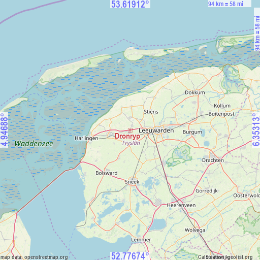
Dronryp GPS coordinates[2]
53° 12' 0" North, 5° 39' 0" East
| Map corner | latitude | longitude |
|---|---|---|
| Upper-left | 53.61912°, | 4.94688° |
| Center: | 53.2°, | 5.65° |
| Lower-right: | 52.77674°, | 6.35313° |
| Map W x H: | 93.7×93.7 km | = 58.2×58.2mi |
| max Lat: | 53.48025° ⇑6.9% North |
| Dronryp: | 53.2° |
| min Lat: | ⇓93.1% South 50.76917° |
| min Long | Dronryp | max Long |
| 3.38611° | 5.65° | 7.16528° |
| W 49.8%⇐ | ⇒50.2% E |
Elevation
Elevation of Dronryp is 1 m = 3 ft, and this is 14 m = 46 ft below average elevation for this country.
| Max E: |
203 m = 666 ft | 83.9% |
| Avg. | 15 m = 49 ft | |
| Dronryp | 1 m = 3 ft | |
Min E: |
-6 m = -20 ft | 16.1% |
See also: Netherlands elevation on elevation.city.
Geographical zone
Dronryp is located in North temperate zone (between Tropic of Cancer and the Arctic Circle). Distance of this North polar circle is 1485.9 km =923.3 mi to North.| Distance of | km | miles | from Dronryp |
|---|---|---|---|
| North Pole | 4091.8 | 2542.5 | to North |
| Arctic Circle | 1485.9 | 923.3 | to North |
| Tropic Cancer | 3309.4 | 2056.4 | to South |
| Equator | 5915.3 | 3675.6 | to South |


Nearby cities:
15 places around Dronryp: (largest is in red/bold)
• Berltsum
4.9 km =3 mi,  0°
0°
• Deinum
5 km =3.1 mi,  100°
100°
• Franeker
7.4 km =4.6 mi,  257°
257°
• Mantgum
9.2 km =5.7 mi,  149°
149°
• Marsum
5.2 km =3.2 mi,  77°
77°
• Menaam
2.1 km =1.3 mi,  20°
20°
• Minnertsga
6.7 km =4.2 mi,  327°
327°
• Sint Annaparochie
8.5 km =5.3 mi, 3°
• Sint Jacobiparochie
8.7 km =5.4 mi,  339°
339°
• Tzum
7.4 km =4.6 mi,  231°
231°
• Tzummarum
8.1 km =5 mi,  300°
300°
• Vrouwenparochie
9.4 km =5.8 mi, 20°
• Weidum
8.7 km =5.4 mi,  134°
134°
• Westeinde
7.9 km =4.9 mi, 83°
• Winsum
5.5 km =3.4 mi,  191°
191°
Sources, notices
• [Note1] Compared only with cities in Netherlands existing in our database
• [Src1] Map data: © OpenStreetMap contributors (CC-BY-SA)
• [Src2] Other city data from geonames.org with taken over terms of usage.
• [Src3] Geographical zone / Annual Mean Temperature by Robert A. Rohde @ Wikipedia
